Photo courtesy of the LeGate Family
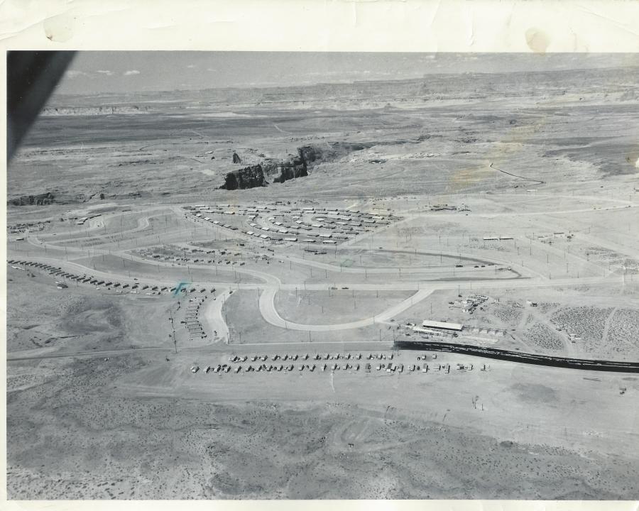
This fantastic aerial shot of Page is undated, but I think it’s safe to place it in the 1957-58 time frame. The original photo is an 8×10 with the following hand written on the back by Gene C. Legate (unedited),
“Gov’t houses under construction. Ours [Legate’s] is 4th house from right end of the line of houses which extend from middle of picture to left toward middle of picture. Other place marked is where we’ll move to shortly. Black road is fresh oil which is put on before asphalt is placed on it. The first 100 houses shown are near completion. The second 100 are now about finished and are in the two blocks below first 100. Dam site in exposed canyon. Temporary school at lower right under construction.”
There is a lot going on in this picture that I would like to talk about. Let’s start at the bottom of the picture. I don’t remember the two lines of mobile homes at the bottom along 7th Avenue (now Lake Powell Blvd), but they are sitting on the approximate location of the Catholic Church. I think there’s a tennis court there now too. The temporary school buildings across the street from the mobile homes referenced on the back of the picture, became the X and Y buildings where I started 1st grade in Mrs. Frye’s class. I have a street-level picture of those buildings, and a story to share with you at a later date. The circular road next to the X and Y buildings was the drive through where buses and parents would drop their kids off for school. I remember it well. That road’s been gone a long time and is now baseball fields, I believe. The high school football homecoming bonfires used to be held in that area.
The row of buildings along the street next to the drop-off loop, that continue on to South Navajo Drive, were the transit (transa?) houses. I think these were originally put there as temporary housing for some of the USBR employees. Someone help me out here if you have more info for us. What I do remember is that they were a bright pink color and they were there for years. Do you see the green pen mark next to the 4th one along Navajo Drive? That is the one referenced in the description on the back of the picture as being where the LeGate family lived for a time. It’s hard to see, but if you enlarge the picture, you’ll see a green square drawn on Cedar Street, also referenced on the back of the picture as “the place…we’ll move to shortly.”
Continue reading Glen Canyon Chronicles