Desert to Destination: Page, AZ (Then & Now)

This video explores the history and present-day reality of Page, Arizona. I grew up in Page during the 1960s – the years when Glen Canyon Dam and Lake Powell were under construction, and I share personal memories from that time.

My co-host Cindy Stafford, a current Page resident, provides updates on what’s happening in the town today. Using archival images throughout, the video concludes with an aerial tour spanning 1958–1973, offering a rare look at how Page emerged from a barren desert to become a destination in just over a decade.

The book recommended in this video:
The Emerald Mile: The Epic Story of the Fastest Ride in History Through the Heart of the Grand Canyon – https://a.co/d/6fdkVeu
Upcoming: A Livestream Aerial Tour of Mid-1960s Page Arizona With Q&A and Live Chat

I’ll be going live on YouTube Saturday, June 7th with an aerial tour of mid-1960s Page with live chat and Q&A. I hope you can join me for this detailed livestream with Q&A in what I hope is the first of many. Mark your calendar for Saturday, June 7th at 10AM Arizona Time, 1PM Eastern Time for a detailed look at Page Arizona in the mid-1960s.

The Upper and Lower Water Treatment Plants

Did you know there was a water treatment plant located in Glen Canyon, downstream of Glen Canyon Dam that served the water needs of Page Arizona until the water treatment plant that currently serves Page was completed? I have photographic evidence so let’s talk about this riveting topic!

The Amazing Glen Canyon Dam Footbridge

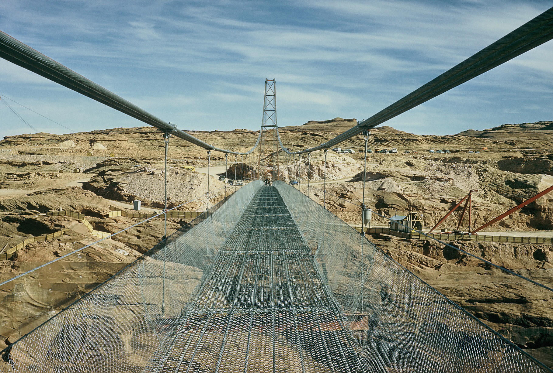
This is one of the clearest photos of the footbridge I’ve seen. This footbridge was just upstream from the dam. This is looking toward the Page side of the canyon. Click image to zoom in. You’ll see people coming toward you at the other end of the bridge, and the small parking area on that side of the canyon. There was also a small parking lot behind the photographer. You can see remnants of that parking lot on Google Earth. That area is closed to public access now.

Early 60s Aerial Tour of Page Arizona

The detail on some of these early aerial photos of Page and Glen Canyon Dam are amazing. In this one, I give you an aerial tour of the town of Page as it appeared in the early 1960s.

5th Avenue Under Construction

Source: Terry Edwards

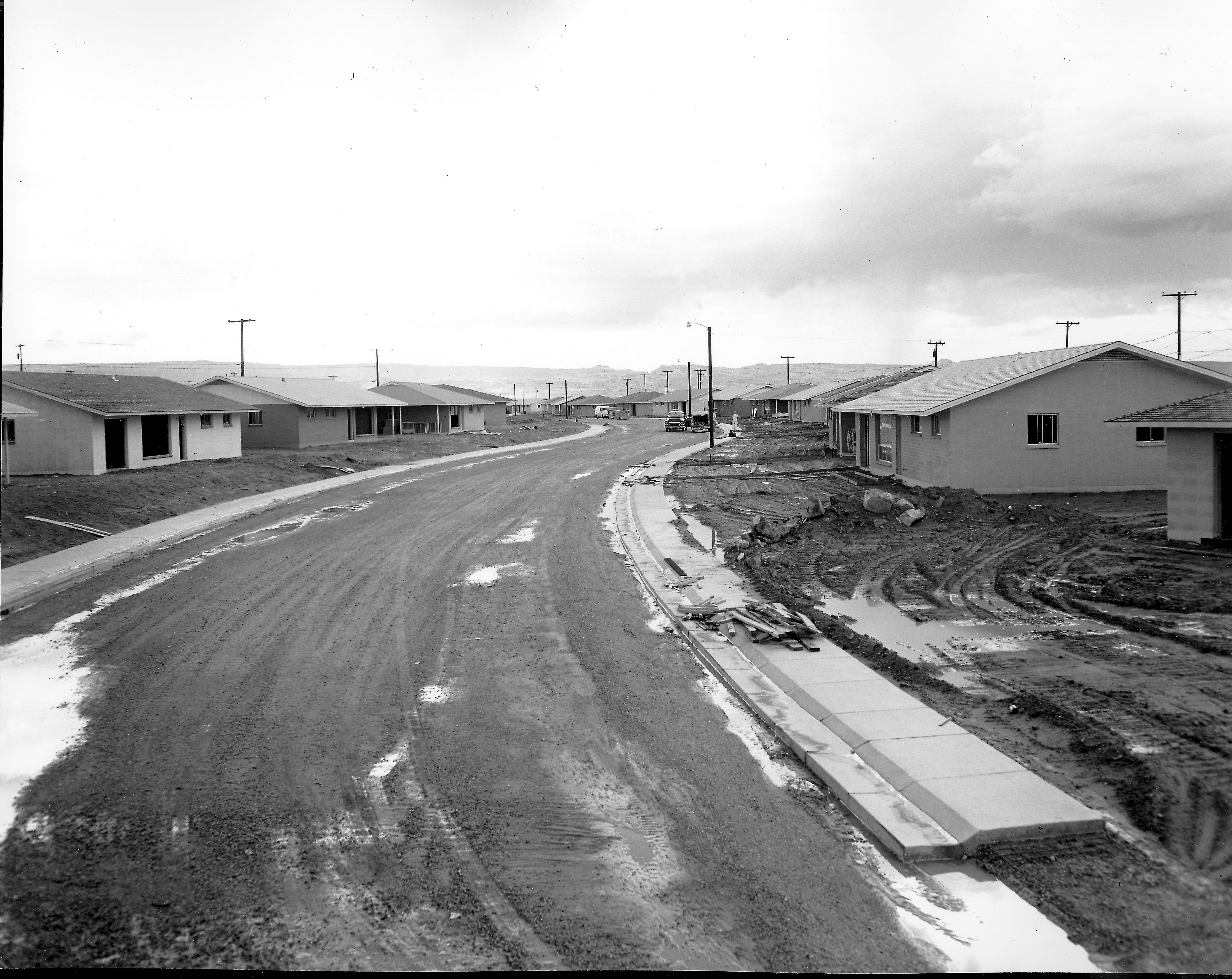
This late 50s/early 60s photo captures a view up 5th Avenue from the Elm Street intersection. The new Page Schools buildings are probably under construction at the top of 5th Avenue. The line of houses at the top of the photo are along Date Street. To the immediate left in this picture would be the original Mountain Bell building. Click to enlarge.

A Rainy Day in Paradise

Source: Terry Edwards. Undated

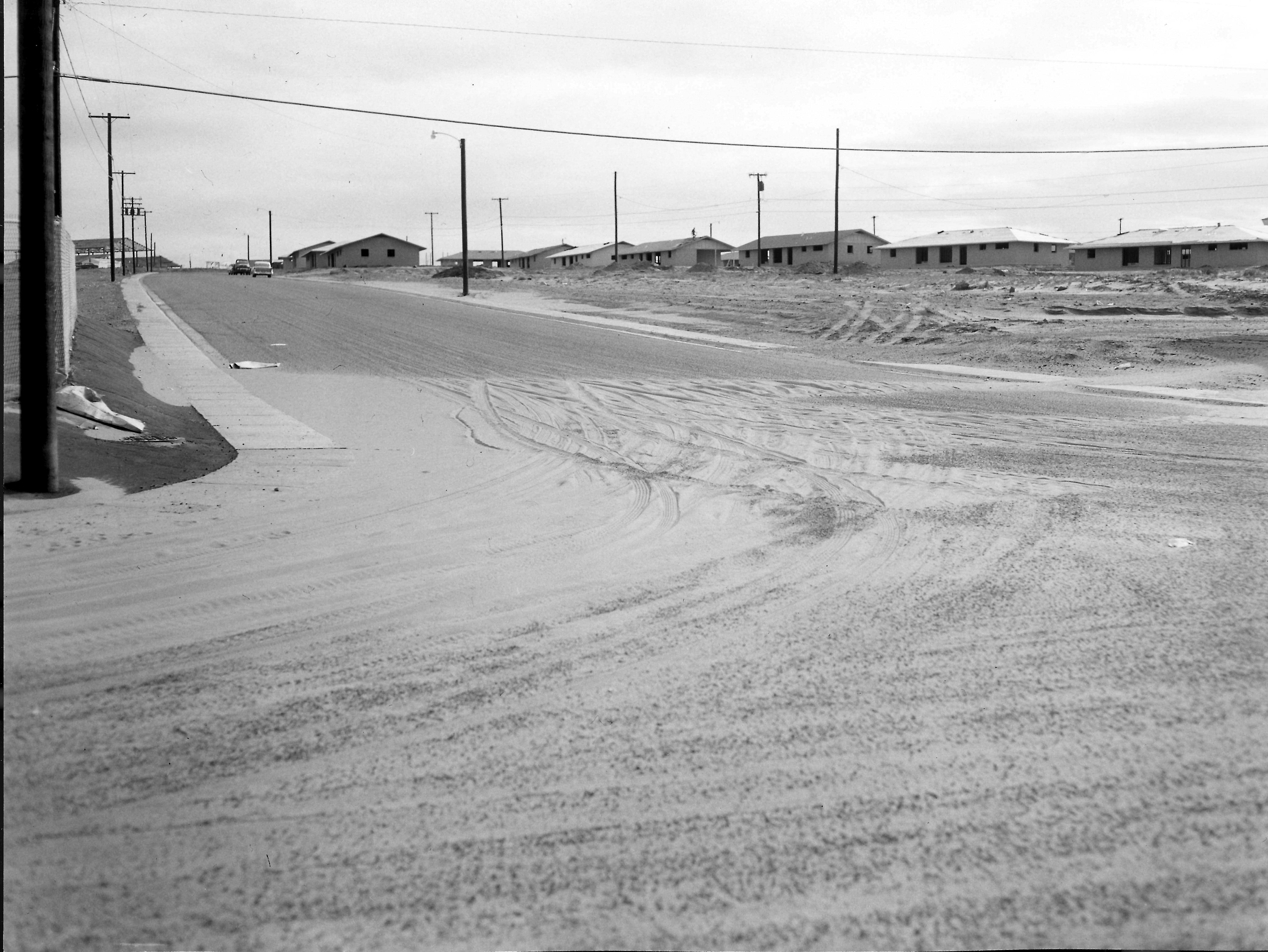
Based on the horizon terrain, this late 50s or early 60s photo may be a look down Gum Street from the 4th Avenue intersection. Best guess. The two houses on the left with their carports next to each other, matches what I see on Google Earth for Gum Street near 4th Avenue. Thoughts? Click on the image to enlarge.

Gunsight Butte Before Lake Powell

Photo: USBR, 1962. Source: The LeGate family. No other caption on back.

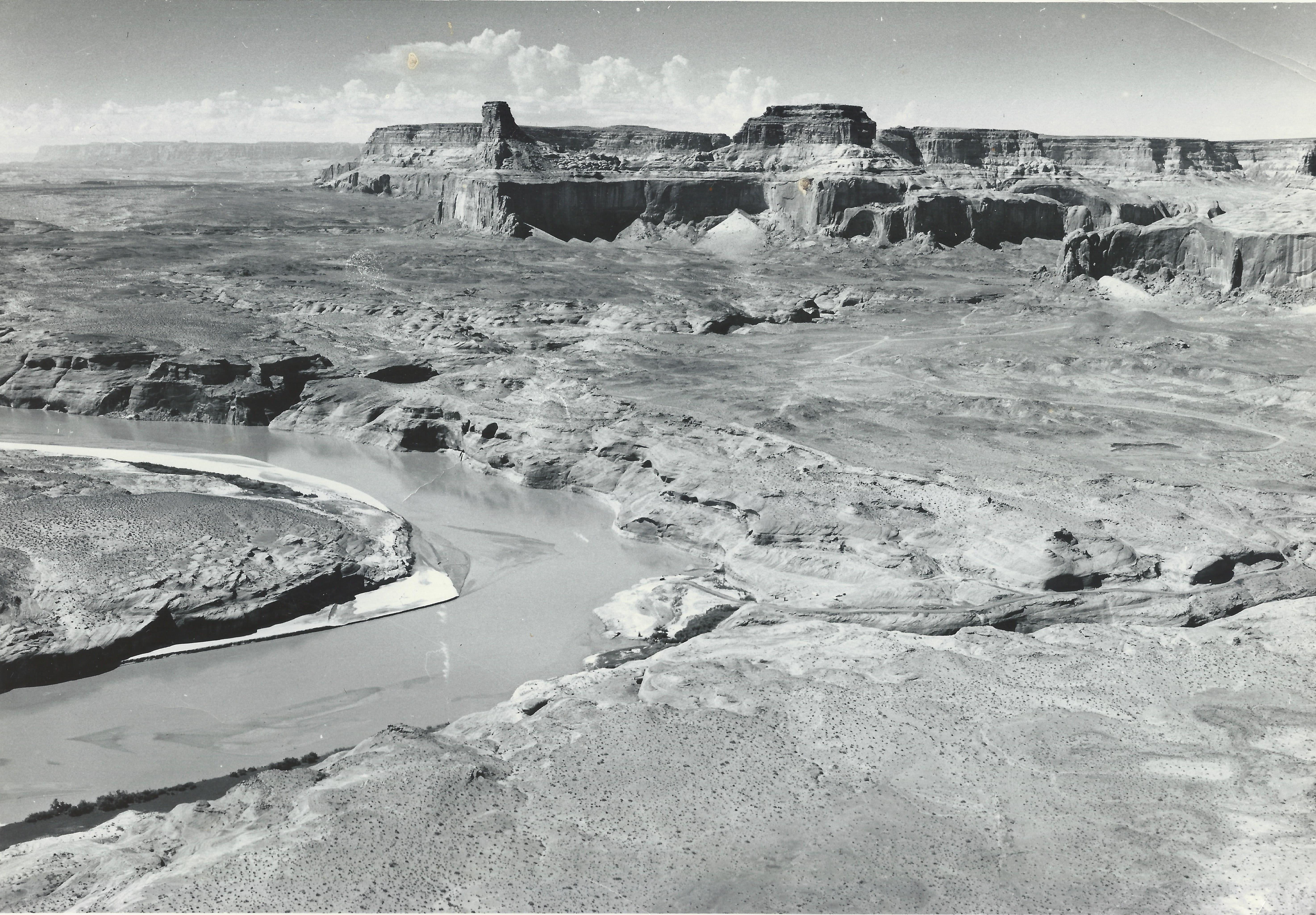
Here’s a 1962 photo of Gunsight Butte before there was a Padre Bay and a Lake Powell. For reference, Gunsight Bay will eventually be on the other side of the Butte and Last Chance Bay is behind the photographer. This view is looking southwest across the future Padre Bay. Click the image to enlarge it in a new window.

Post-Construction Glen Canyon Dam Site

Photo: F. S. Finch, USBR. July 23, 1965. My Source: Tim McDaniels.

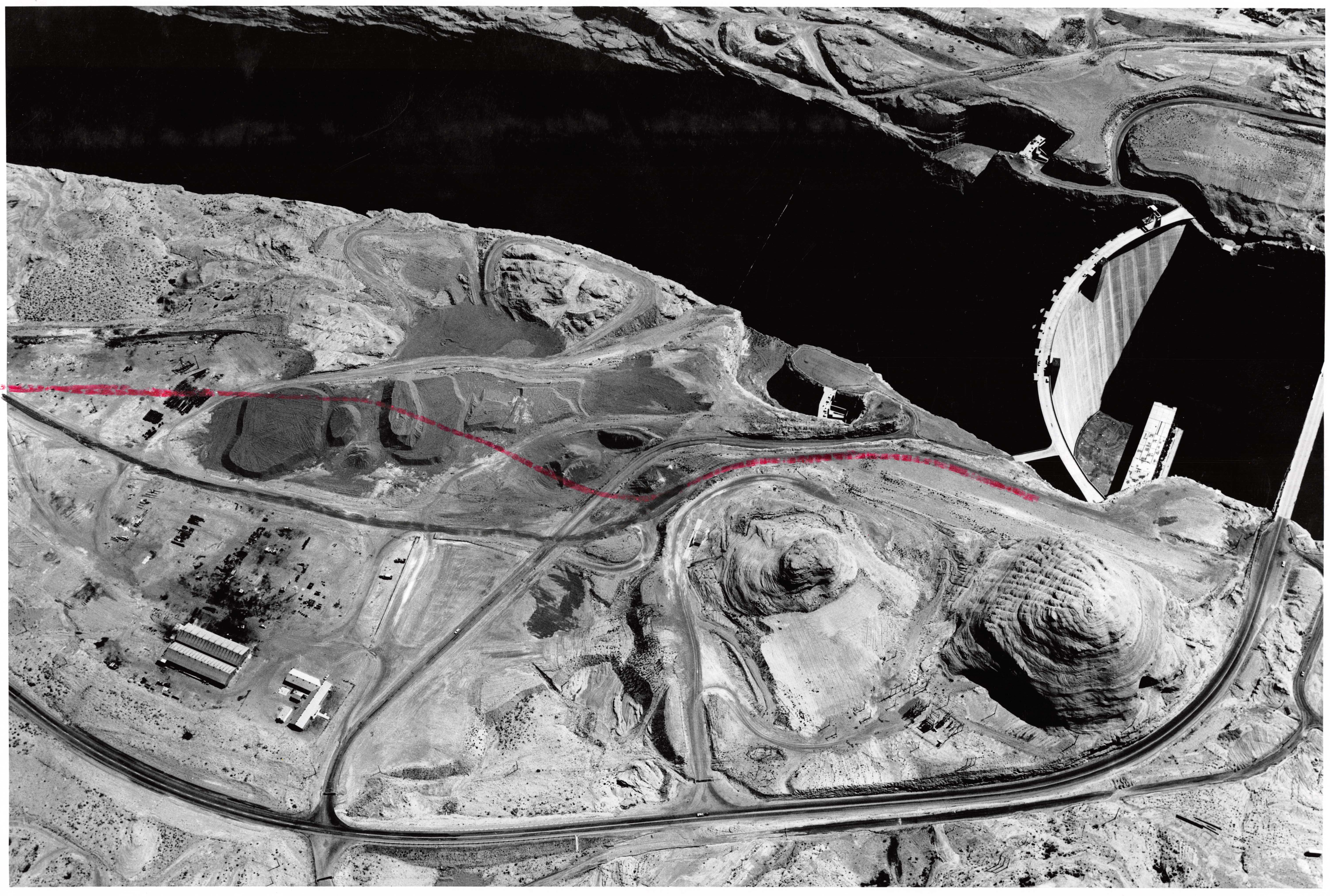
This is a great 1965 aerial photo of the Glen Canyon Dam site. It shows the remnants of the construction days and what was still in place from those years. Click on it to enlarge it in a new window. You’ll notice on the right side of the photo that the cableway towers, which were between the Beehive and the canyon wall, are gone and the tracks they rode on have been removed. Construction of the Visitor’s Center hadn’t begun yet.

Moving upstream along the canyon, both spillways are clearly visible, as is the horseshoe-shaped road/parking area where the footbridge once stood. The faint white-dashed line spanning the canyon was the log jam to prevent boaters from getting too close to the dam and spillways. The nighttime trout fishing with the boat tied to the log jam was always good.

The aggregate piles are still there where the conveyor belts once stood. The red line on the photo may have been a proposed route for the road to Wahweap. There are still a few buildings from the construction days and an electric substation near the Beehive. I made a then-and-now post of the Beehive you can see at The Beehive Then and Now.

-Enjoy!