A 7th Avenue Parade

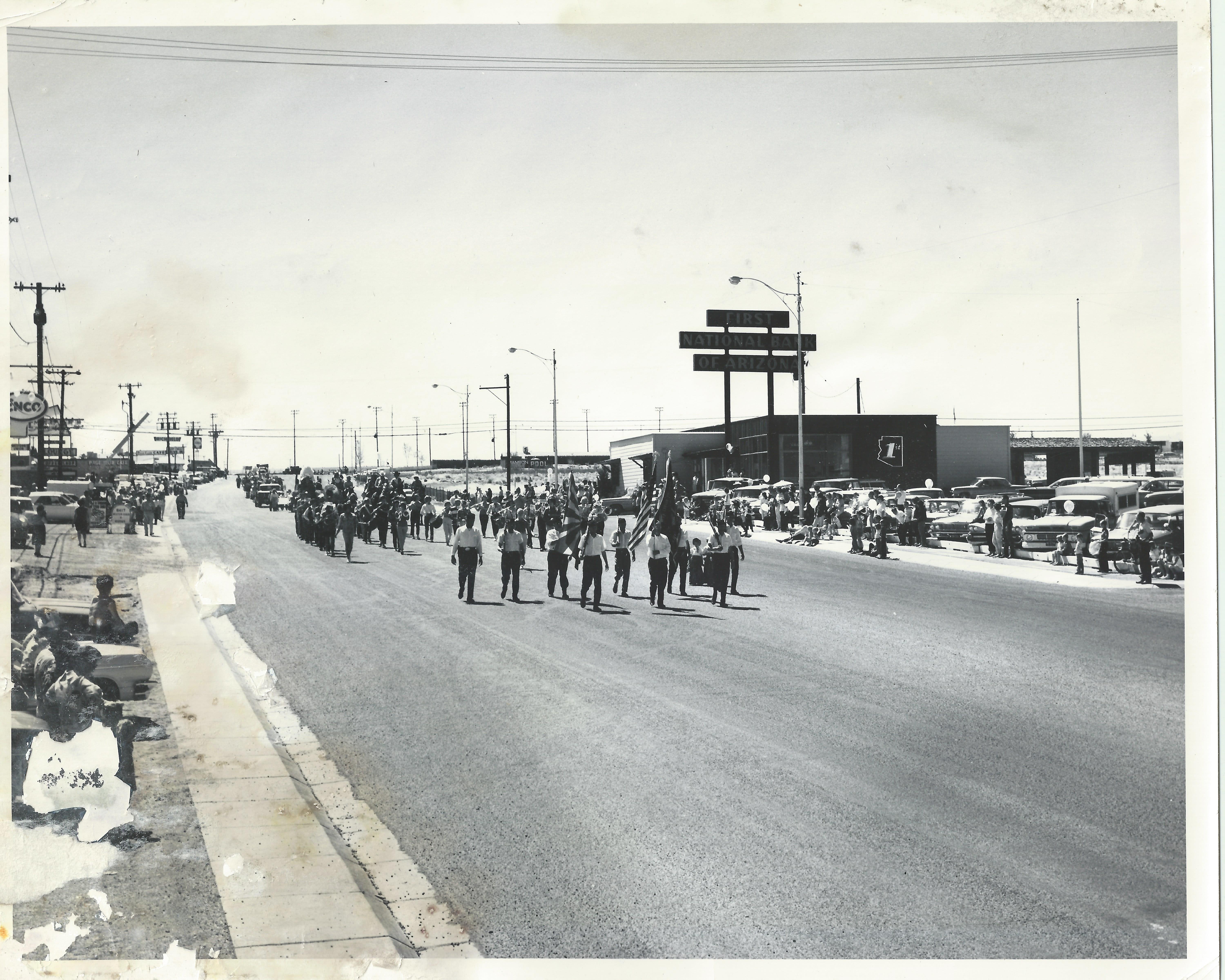
Source: The LeGate family. No caption on back. This photo is undated.

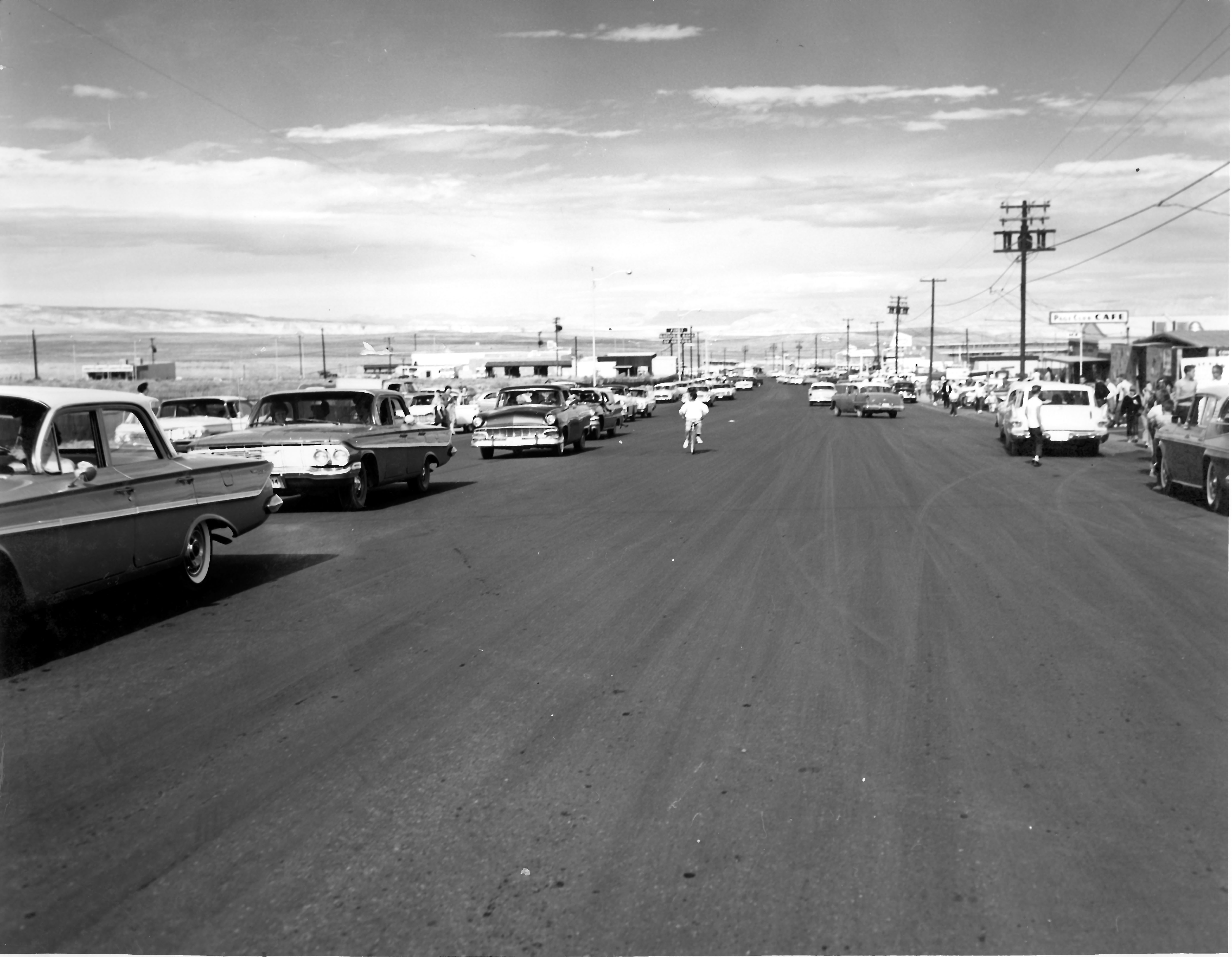
Last Friday I posted a photo looking down 7th Avenue (Lake Powell BLVD). You can see it HERE. Here’s another one looking up 7th Avenue from a vantage point near The Bottle Stop. The Bottle Stop was located where STIX Market is today. If you click on this image, you can zoom in on it to see more detail. Check out the “Page Club Cafe” painted on the side of the cafe, as well as the sign. You can see the Richfield, Shell, and Enco gas station signs as well. The Empire House and Toga Room Lounge signs are visible. On the right side of the street in the way back, the Manson Mesa Pool sign is clearly visible on the pool fence. The First National Bank sign looms large.

Are you in this photo or do you have more specific info you can share about this day? If so, please leave a comment. I recognize some of the vehicles in this picture, particularly the pickup truck with the camper shell near the far right of the photo. I don’t know who owned it but I’m pretty sure he lived in Chapman’s Trailer Park.
The Page Park Six

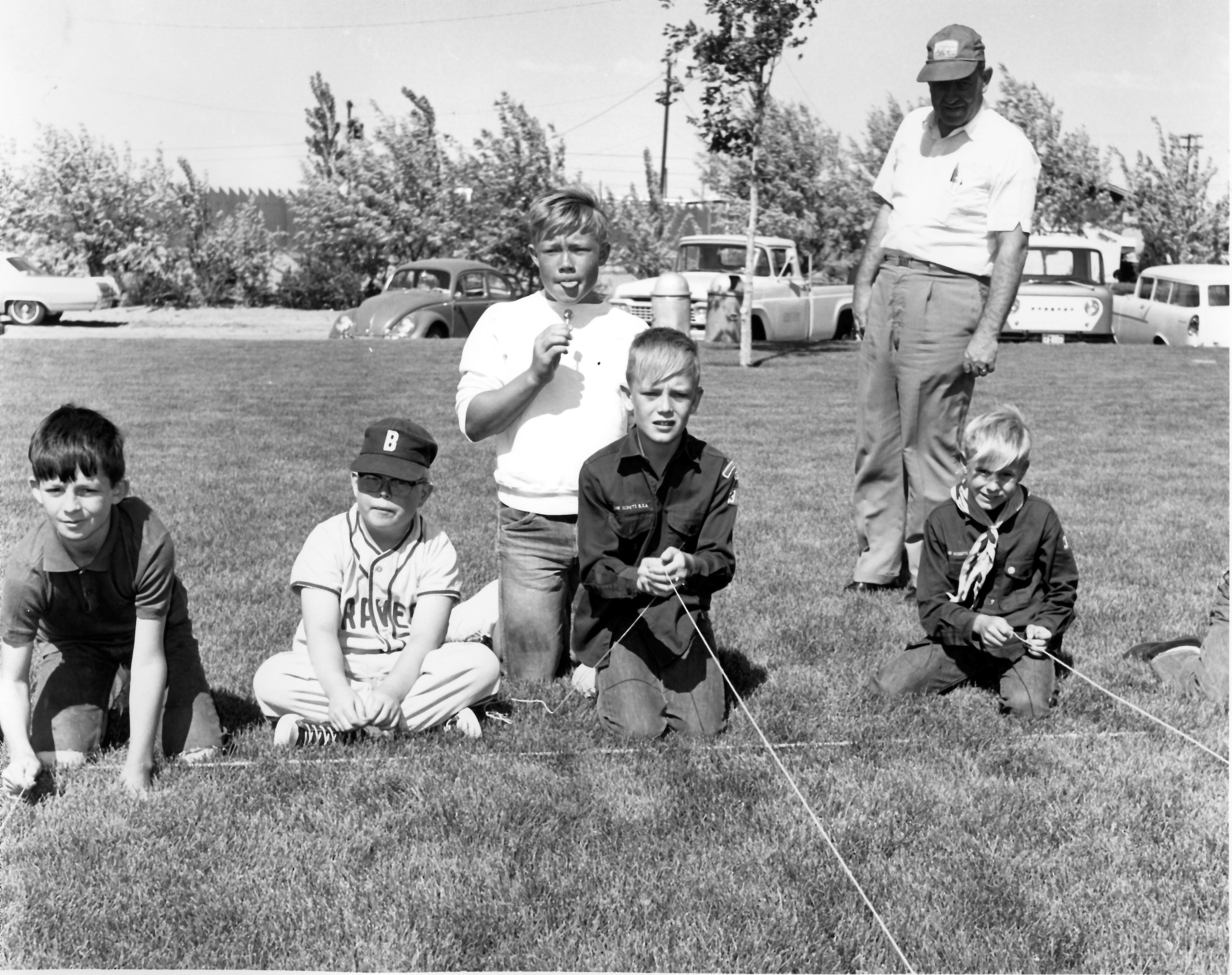
Source: Terry Edwards. Undated.

I respect the privacy of others, so I’m always a little hesitant to tag anyone of social media. But sometimes a picture screams to be posted and this is one of those times. If you’re in this, you know who you are and so do I. If you want to tag yourself or let others know you’re in it, go for it. This photo is at the Page Park and the Manson Mesa Pool is in the background behind the fence.

Snow Day

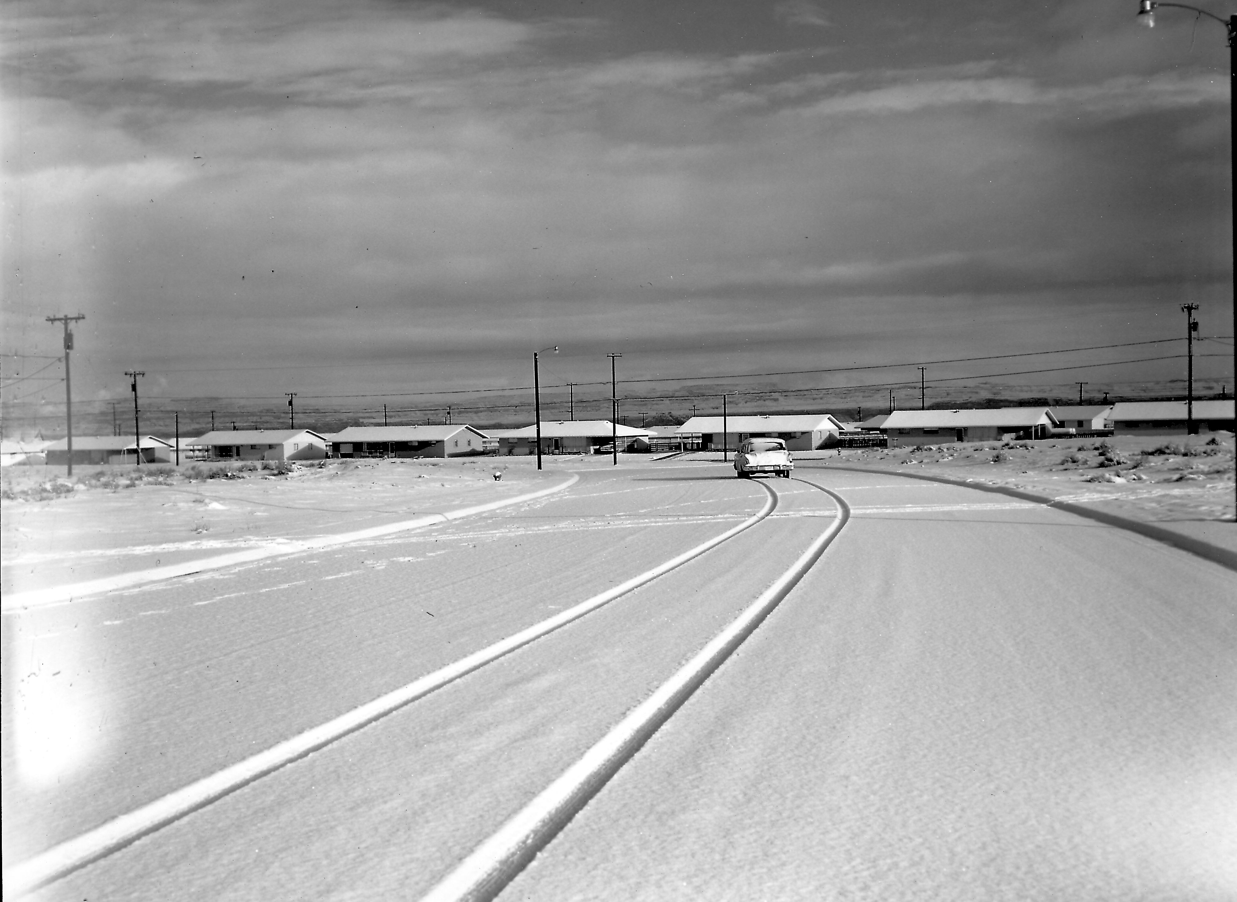
Source: Terry Edwards. Undated.

A chilly snow day sounded good as I sit here in the summer heat of the southwest. This photo is undated but must be early 60s. These snowstorms could bring some nice clouds to the area and sometimes would stick around for weeks. This could be Second Avenue looking toward Date Street. Second Avenue sat empty of houses for years until construction began on the power plant and the town’s population began to rise again. Click on the picture to enlarge it and zoom in.

A Look Down Early 7th Avenue

Source: Terry Edwards

This photo is undated but it’s 1960ish, give or take a year. I don’t know what the event was. Possibly a parade. We had a lot of those back then. This view is looking down 7th Avenue toward the dam site. It’s now Lake Powell BLVD. The Pink Sans Drive-In is just off the picture to the right and the Manson Mesa Pool is just off the picture to the left. You can see the Page Club Cafe and the Empire House on the right. To the far left is the brand new Rexall Drug sitting all by itself. First National Bank of AZ is also visible on the left. The road hasn’t been paved yet. Click on the picture to enlarge it and zoom in.

Were you there on this day? Do you remember what was going on? If so, leave a comment.

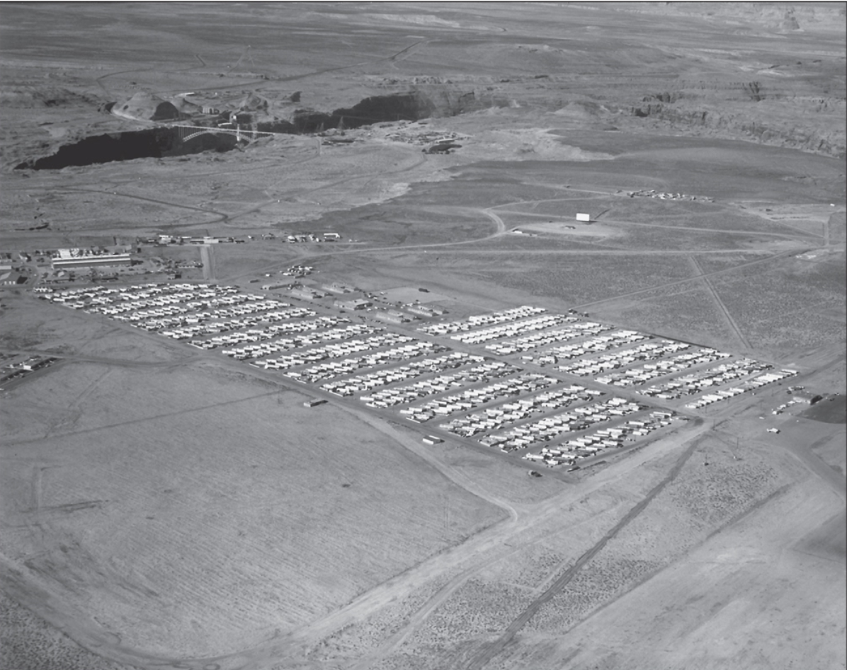
Page Trailer Court 12-14-1960

Photo: USBR, 12-14-1960

Here’s a great shot of the Page Trailer Court dated 12-14-60. Click on it to zoom in and scroll to the far right. Do you see the trailer sitting at an angle behind the airport hanger? That was our trailer. Yea!!! I finally found a picture of it to prove I existed. You’ll also see the drive-in theatre screen and the corrals in the background. The trailer court eventually expanded to include more streets/trailers on the left side of the court, similar to the expansion you see already in place on the right side. At the far left of the photo, you’ll notice a couple of the MCS apartments.

Video: Glen Canyon Dam Construction

I came across this video showing some good footage of the Glen Canyon Dam construction as well as some great shots of early Page Arizona. Some of the narration gets a little cheesy but the footage is amazing. You may even recognize some of the faces. I was surprised to see Chet Huntley narrating it. After the first minute and half to two minutes in, it picks up and gets good. The total length is only 27 minutes.

Enjoy!

We Need to Talk

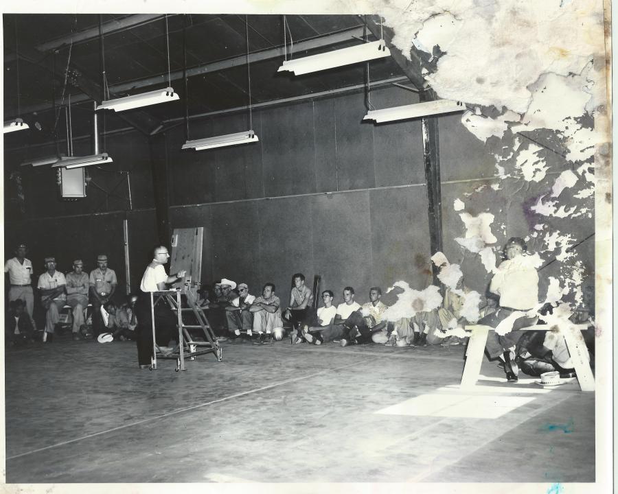
Source: The LeGate family. No caption on back.

I’m glad I was able to scan this photo before there was any more water damage. I’m not sure what this meeting was about, or where it occurred for sure. There was nothing written on the back. Was this inside the USBR warehouse? Are you in this picture? Do you recognize anyone in it? Please leave me a comment if you do.

-Mike

Glen Canyon Dam Nears Completion

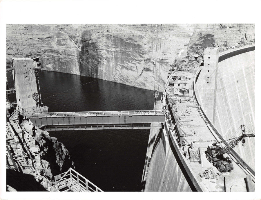
Thanks Tim McDaniels for supplying this photo showing the service road bridge being placed as construction on Glen Canyon Dam nears completion in 1964. The back of the photo reads:

“Glen Canyon Unit: Girders for the right abutment service road bridge being lowered into place by the two 50-ton high lines.”

The concrete batch plant is still standing on the left side of the picture, but its days are numbered. Click on the photo and zoom in to see the details. These old black & white USBR photos have incredible resolution. Click the photo for a closer view.

-Mike

On The Streets

Here’s a look back and a reminder of how Page looked in those early days. Most of these photos are scattered throughout other posts but I wanted to get them into the same post, so here they are!

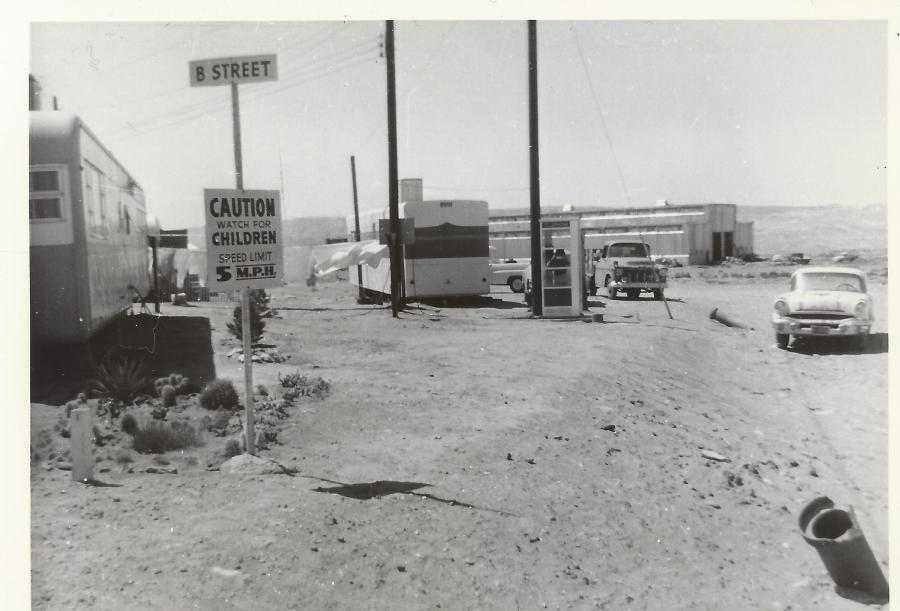
This is in the MCS trailer court at the corner of B Street and what is today, Aero Ave, looking northwest. The USBR warehouse is in the distance.
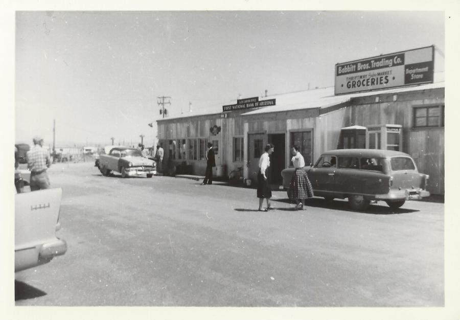
1957 Page Business District. Donna Taylor (the first graduate of PHS) and Petey Lloyd Dietz talking in front of Babbitt’s. This building was located behind present-day Stix Market. The MCS Trailer Court is visible in the background. Photo courtesy of Petey Lloyd Dietz.
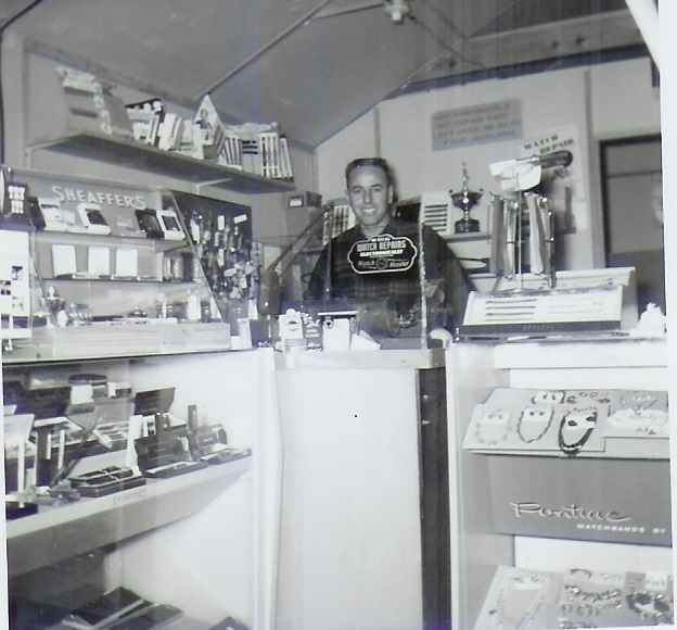
Ernie Severino inside the original Page Jewelers. Photo courtesy of Ernie Severino Jr. Undated.
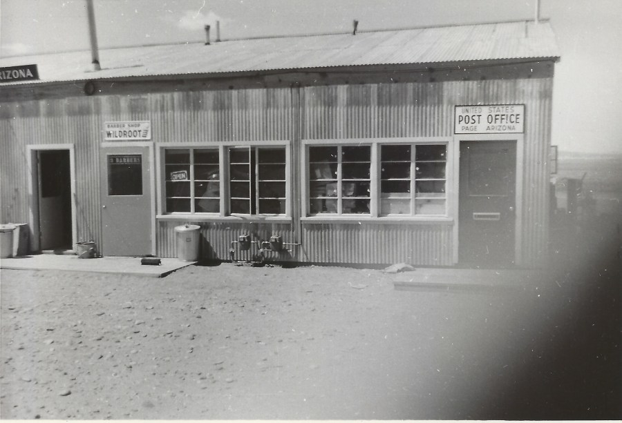
Here’s a shot of the old Barber Shop and Post Office. The sign on the barber shop door says there were 3 barbers at that time. I only remember Hank. Photo courtesy of Petey Lloyd Dietz. Undated.
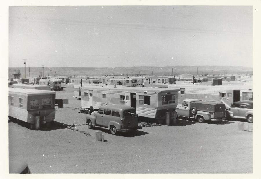
Here’s a nice view of the MCS Trailer Court. Photo courtesy of Petey Lloyd Dietz. Undated.
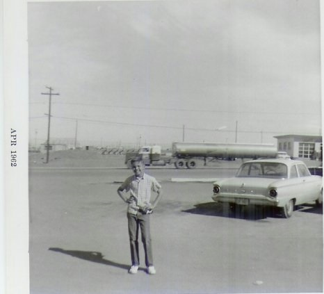
Mike Severino in front of present-day Lake Powell BLVD. That’s Keisling’s service station on the right. Photo Courtesy of Ernie Severino Jr. April, 1962
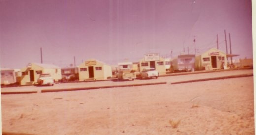
These huts housed a handful of Page businesses in those early years. Most (if not all) of the business owners lived in trailers next to their store as seen in this photo. These buildings were along North Navajo Drive opposite the USBR warehouse. Babbitt’s, the bank, etc were located to the right of this picture. Photo courtesy of Ernie Severino Jr. Undated.
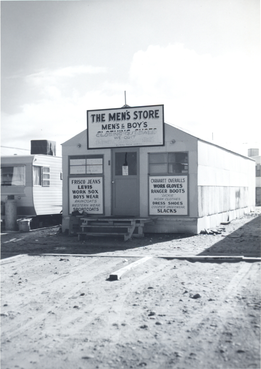
One of those early businesses was The Men’s Store. The closing of this store may have coincided with the strike in 1959. If anyone can confirm or deny that, please let me know. Photo courtesy of USBR. Undated.
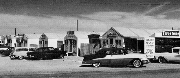
Another perspective on the old business huts that were along North Navajo Drive. If I remember right, Firestone was owned by the Warners. You can zoom in to see the other signs. Photo courtesy of Terry Edwards. There is no specific date but it was late 50s or very early 60s.

That’s all for now. Enjoy!