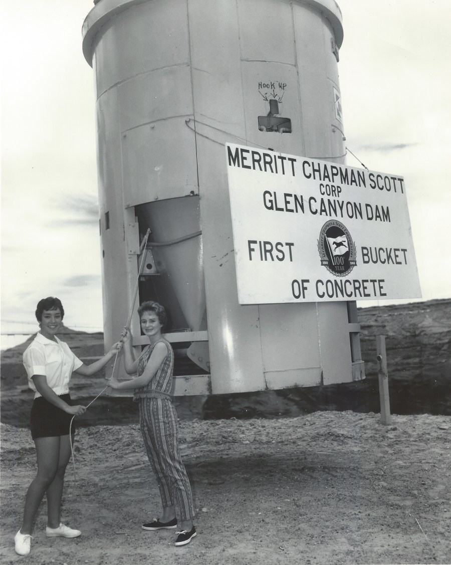
Photo: A. E. Turner, USBR. Linda Farris and Petey Lloyd Dietz and a really big bucket. Photo courtesy of Petey Lloyd Dietz.
This photo of Petey Lloyd Dietz and Linda Farris is amazing and it’s one of my faves! The back of the photo reads:
“P-557-420-4905, Glen Canyon Dam. Petey Lloyd and Linda Farris demonstrate the procedure for releasing concrete from the giant 12-cubic-yard capacity concrete bucket. They show how Secretary of the Interior Fred A Seaton will pull the lanyard and trip the first bucket of concrete on June 17, 1960. 5/26/60, Bureau of Reclamation Photo by: A.E. Turner”
Petey told me, “P.S., Our father, Lewis H. Lloyd, was the (first) concrete superintendent on the dam from 1957 – 1963. Perhaps I had a little ‘in’ on being selected for this photo.” 🙂
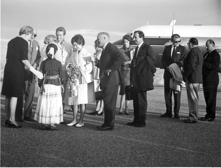
Photo courtesy USBR. November 13, 1965. Source: Terry Edwards
On November 13, 1965, Princess Margaret and Lord Snowdon arrived in Page where they were greeted by approximately 500 residents. They stayed at the Lake Powell Motel that was located on Highway 89, but has since been torn down. L-R in the photo above: Dora Knight; U.S Ambassador to the UK, Lewis Williams Douglas (more info); Rosalind Acothley (in traditional Navajo dress, with her back to the camera); Lord Snowdon; Princess Margaret; and Royce Knight. Art and Bill Greene are the two men at the far right of the photo.
Here are some other sources you might be interested in concerning this visit:
Both pictures are included in this e-book on Page and Lake Powell. Here’s a link to the preview. I purchased this book and am enjoying it. See the preview.
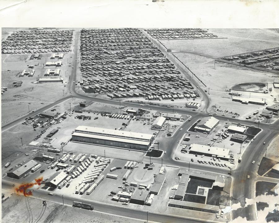
This first picture is undated, but it’s from the 60s. When I moved all of my pictures to a new computer, the meta data didn’t come with them, so I’ve lost all the dates and photographer info that was written on the back of them. But check this out:
That was then. Source: The LeGate Family. Undated
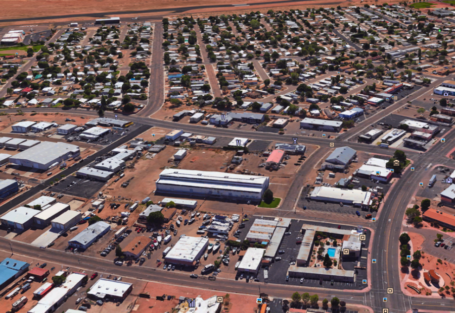
You might want to click on that picture and open it while we talk about it. This is a look down present-day Aero Ave, looking toward the airport. The long building in the center was (is?) the USBR warehouse. To the right of it is the bowling alley and below the bowling alley is the Page Boy Motel. The street at the bottom is Vista Ave. Looking down Aero Ave toward the airport, I believe the first long building on the left was Page Market. I seem to remember the H-shaped buildings being barracks and a mess hall built early-on for construction workers on the dam.
The small buildings lined up at the near end of the trailer court were early Page businesses. Rexall Drug, Page Jewelers, and a Men’s Store were among those buildings. Was there a shoe store there too, or was that part of the Men’s Store? It’s all a blur sometimes. The building below the Little League field on the right of the picture was the original location of Babbitt’s and First National Bank of AZ, and the barber shop. I don’t remember if there was anything else in there. It looks abandoned in this picture, so the permanent buildings may have been in place by the time this photo was taken.
To the right of the baseball field, you can see a little bit of the concrete slab that was used to show outdoor movies and for dances. Above it, you can see a corner of the MCS apartments. Do you see that building by itself on the curved road from the MCS apartments to the trailer court? Did that serve a dual purpose? Was it both the Teen Canteen and the American Legion hall? For some reason that sticks in my mind. If you look at the very top of the picture and zoom in, you’ll see the airport hanger on the left. The dark area just below the hanger was our trailer. The small trailer to the right of the hanger was the Bonanza Airlines terminal. There was also an elevated platform near that trailer that served as the “tower” for Bonanza Airlines. Whenever the airline was on its way in or taking off, the airline guy (I don’t remember his name, but he lived on First Ave) would go up on that platform and talk to the pilot via radio. As a young kid, I always thought that was pretty cool. Zoom into this picture and look at the detail. You’ll see people walking, cars on the move, and one car with its hood up.
Here’s a shot I took this morning from Google Earth, showing that same area. I tried to get as close as possible to the same angle. This screen shot was taken today, 3/31/18 but the Google info on the photo is dated 4/6/2015. Enjoy!
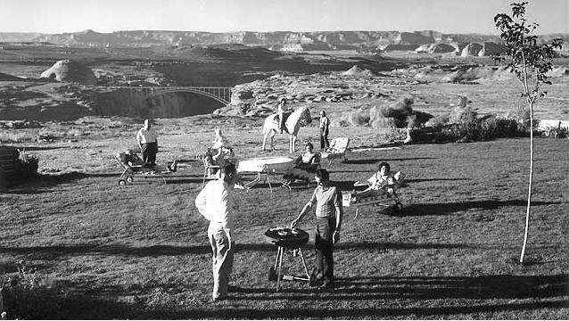
Undated and Unsourced. Royce & Dora Knight’s back yard?
This picture is undated and I don’t remember where I got it. I’m guessing it’s 1962-ish, based on the height of the dam and the fact it’s not visible yet. It gets pretty grainy when you zoom in, so I can’t make out any of the faces. But I think the guy in the white shirt standing in the back on the left could be Royce Knight. Just a guess. How about you? Do you recognize anyone? Check out the chaise lounge chairs. And that poor tree needs to be staked before the Page winds rip it out of the ground!
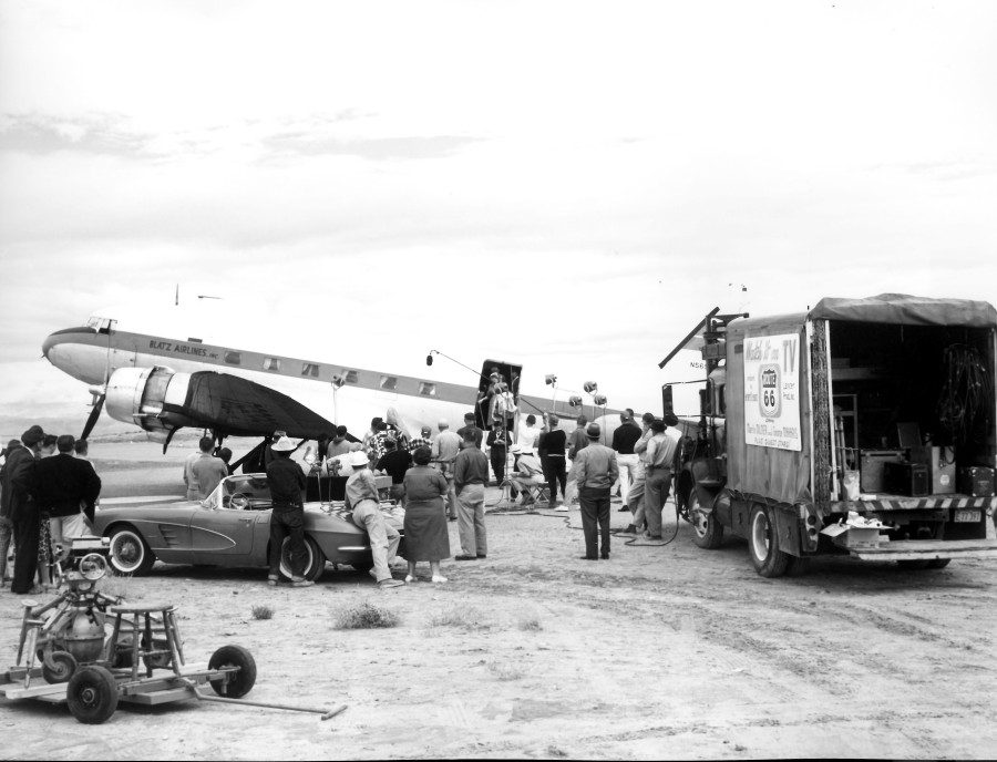
In 2013, I posted a blog about an episode of the old TV series, Route 66, being filmed in Page. You can see that post >HERE<. If Route 66 was before your time, it was a show about two guys – Tod (with one “d”) and Buz (with one “z”) – driving the old Route 66 in a cool Corvette Stingray and doing stuff. You may know Route 66 as Interstate 40. Season One, Episode Nine of Route 66 was filmed in Page and at the Glen Canyon Dam site when it was under construction. This episode aired on November 2, 1960 and was entitled, Layout at Glen Canyon. Construction on the dam was in its early stages and the bridge dedication took place the year before.
In this post, I want to tease out a little more trivia by way of some still images I made of the show while watching it. Some of these are little blurry but clear enough to see what’s going on. Enjoy!
This first image above is one I used on the original post in 2013. They’re filming the scene where the women are getting off the plane. Click this image and enlarge it. Take a look at the all the details and notice the sign on the side of the truck. I’m not sure what the thing on the cart is. Careful leaning on that Corvette, people! We lived at the airport (literally) and this scene wasn’t too far from our trailer’s front door. But I don’t remember them making this show. Here are some stills from the show:
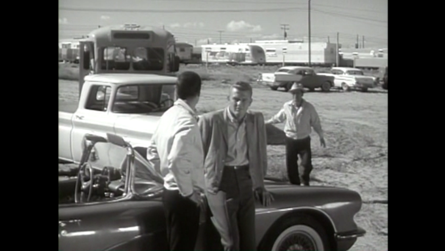
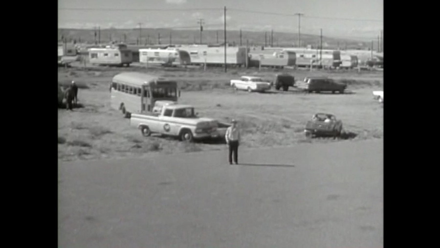
This early scene shows Tod (Martin Milner of Adam-12 fame) and Buz (George Maharis) in a deep discussion just before the models get on the bus to be escorted to where they are staying, which was a couple of trailers somewhere near where the “P” is painted along US89. You can see Manson Mesa in the background of the scenes filmed at those trailers if you watch the show. In the picture above, the line of trailers is P Street, the last street of the MCS trailer court, next to the airport. Our trailer was to the right of this picture right behind (literally!) the hanger. Here’s a wider shot of the same area:
The picture above is a wider shot of the trailers behind the airport along P Street. The dirt driveway that Tod and Buz are headed to was the entrance off of P Street to the airport and the driveway to our trailer to the right of this picture. Here’s another action shot of the same scene: Continue reading →
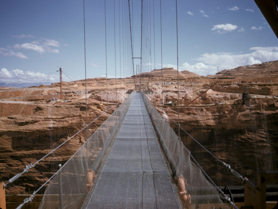
The shortest distance between two points is a straight line. Here’s proof:
This shot of the footbridge was buried in a PowerPoint presentation that was sent to me a few years ago. It’s undated. Click on it to enlarge.
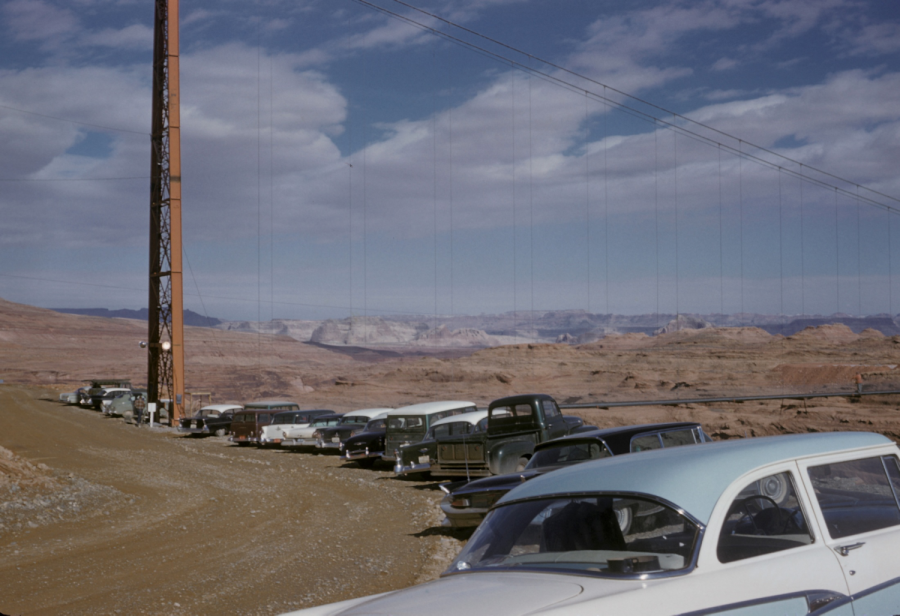
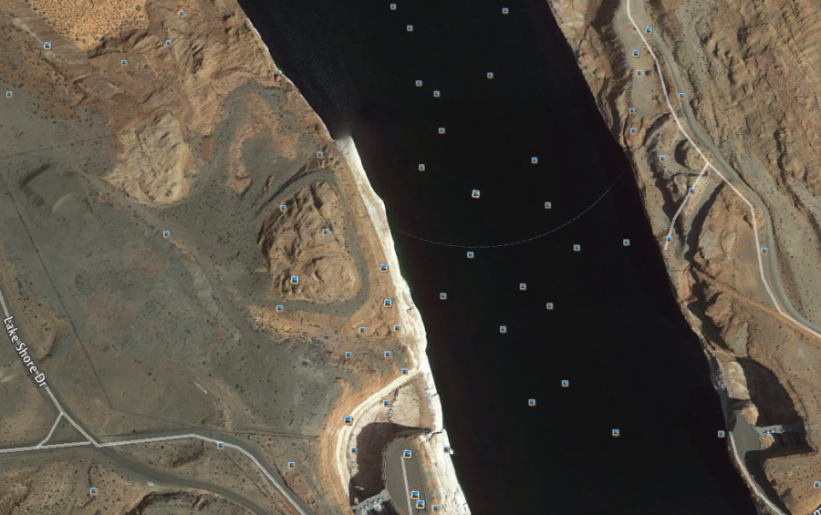
The photo above was taken from the west side of the canyon. Behind the photographer was a circular parking lot built around a small sandstone hill. The next photo shows the parking lot and the photo below it is an image I took today using Google Earth that shows the remnants of the circular parking area as it appears today. This temporary foot bridge spanned Glen Canyon and was located just upstream of Glen Canyon Dam.
Here’s a view of the parking area on the west side of the upper footbridge.
Here’s the image I captured this morning on Google Earth showing how the parking area appears today.
From Google Earth. The horseshoe-shaped parking area is wrapped around the sandstone hill on the west side of the canyon. The spillways are visible at the bottom of the photo.
I’ve written other posts about the upper footbridge. To see them all, type “footbridge” in the search box at the top of the page.
This shot looks like it was taken at Horseshoe Bend. Horseshoe Bend is off of highway US 89 just south of Page.
The area around Page has always been a prime location for movies and TV shows. The rugged and unusual terrain in the area makes it a unique spot for movie making. Here are a few of the movies/TV episodes I remember being filmed near Page:
Route 66 Season 1, Episode 9, Layout at Glen Canyon (1960)
The Greatest Story Ever Told (1965)
Planet of the Apes (1968)
Easy Rider (1969)
The Outlaw Jose Wales (1976)
Greatest Heroes of the Bible (1978) – A made for TV mini-series. I was an extra in one of these episodes and will be signing autographs later.
Superman III (1983)
Maverick (1994) – There’s a scene in this movie with houseboats visible in the background. Ooops!
Broken Arrow (1996)
Planet of the Apes (2001)
Gravity (2013)
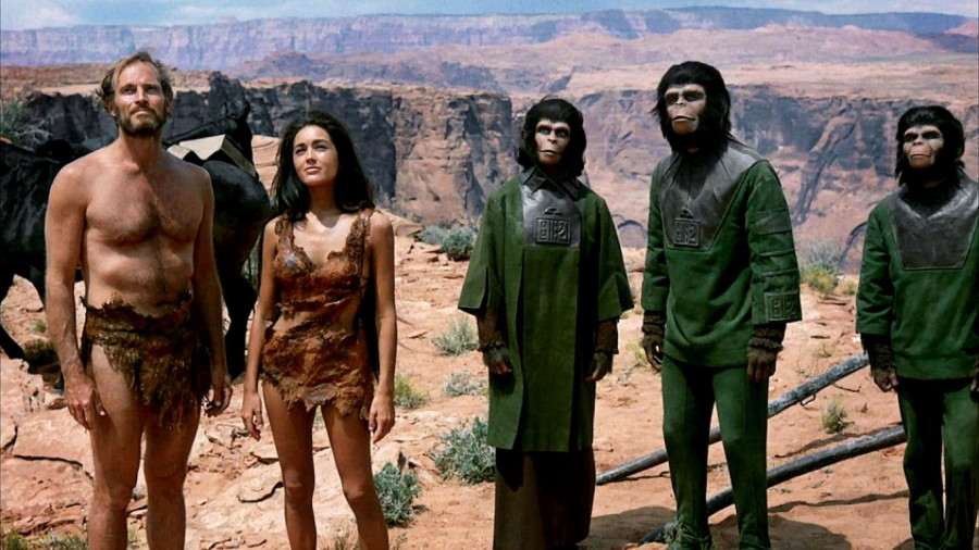
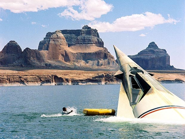
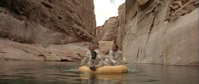
There were more, but you get the idea. Here are a couple more pictures I wanted to share with you from the first Planet of the Apes, filmed at Lake Powell in 1968, four years after the completion of Glen Canyon Dam. I don’t remember where I got these.
Those cool waters of Lake Powell were always so refreshing on hot days.
Boating and fishing in these side canyons was always a treat. But as we all know, these guys are heading toward disaster.
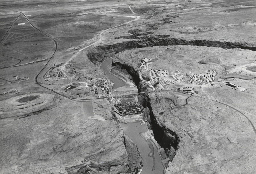
Here’s another aerial view of the Glen Canyon Dam construction site. This is looking upstream toward Wahweap creek. It’s a good look at the coffer dam, the early stages of the dam itself, and the power plant. The crane towers are visible on each side of the dam. If I remember right, there were two 25-ton towers and one 50-ton tower on either side. These crane towers moved back and forth along tracks. The road down to the visitor lookout site is visible on the right side of the canyon, coming off of US89. The oval shaped area was the parking lot and you can see the walking trail down to the lookout point. The footbridge is faintly visible in this photo too.
Lake Shore Drive, which was still dirt, is clearly visible. It was built and used for hauling gravel to the concrete batch plant at the dam site. Aggregate was trucked in to the batch plant from Wahweap Creek and dumped in an underground hopper at the base of the conveyor belt, visible in this picture near the end of the road. The aggregate was processed and conveyed to the concrete mixing plant seen in this picture on a large shelf cut out of the canyon wall. That concrete mixing plant was about twenty stories tall. The mixed concrete was dumped into a rail car that in turn, dumped the concrete into the buckets suspended by the cranes, for their trip to the topmost section of the growing dam. That’s the abbreviated story of the process. I always wanted to go inside that mixing plant but I never got the chance. Click on the image to enlarge it. Download it and check out the detail.
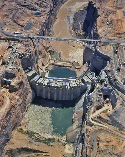
Glen Canyon Dam Construction, 1962 or 63. Source unknown.
There’s a lot of good detail in this photo.It’s a good look at both spillways and the temporary coffer dam at the bottom of the picture. The concrete batch plant is visible on the canyon edge to the right. Water is visible exiting the right diversion tunnel, but not the left. The left diversion tunnel inlet was about 33 feet higher than the right tunnel inlet and was intended to be used only during high river flows. The parking lot for the lookout point is visible on the left, just above the bridge. The rectangular building along the highway on the left side of the bridge was the original visitor’s center. It was later moved into town and became the LARC center. I don’t remember what that acronym means. The rail-mounted cranes are visible on either side of the canyon. There were two 25-ton cranes and one 50-ton crane on each side. In addition to transporting buckets of concrete to the dam, these cranes were used to transport people and equipment in and out of the dam site. Near the bottom right corner of the picture, you can see the tower structure holding the footbridge, and the footbridge is visible too. The dark area by that tower, that curves around the sandstone knoll, was the road/parking lot for the footbridge. You can still see the remnants of that road on Google Earth. Go take a look.
 Glen Canyon Chronicles