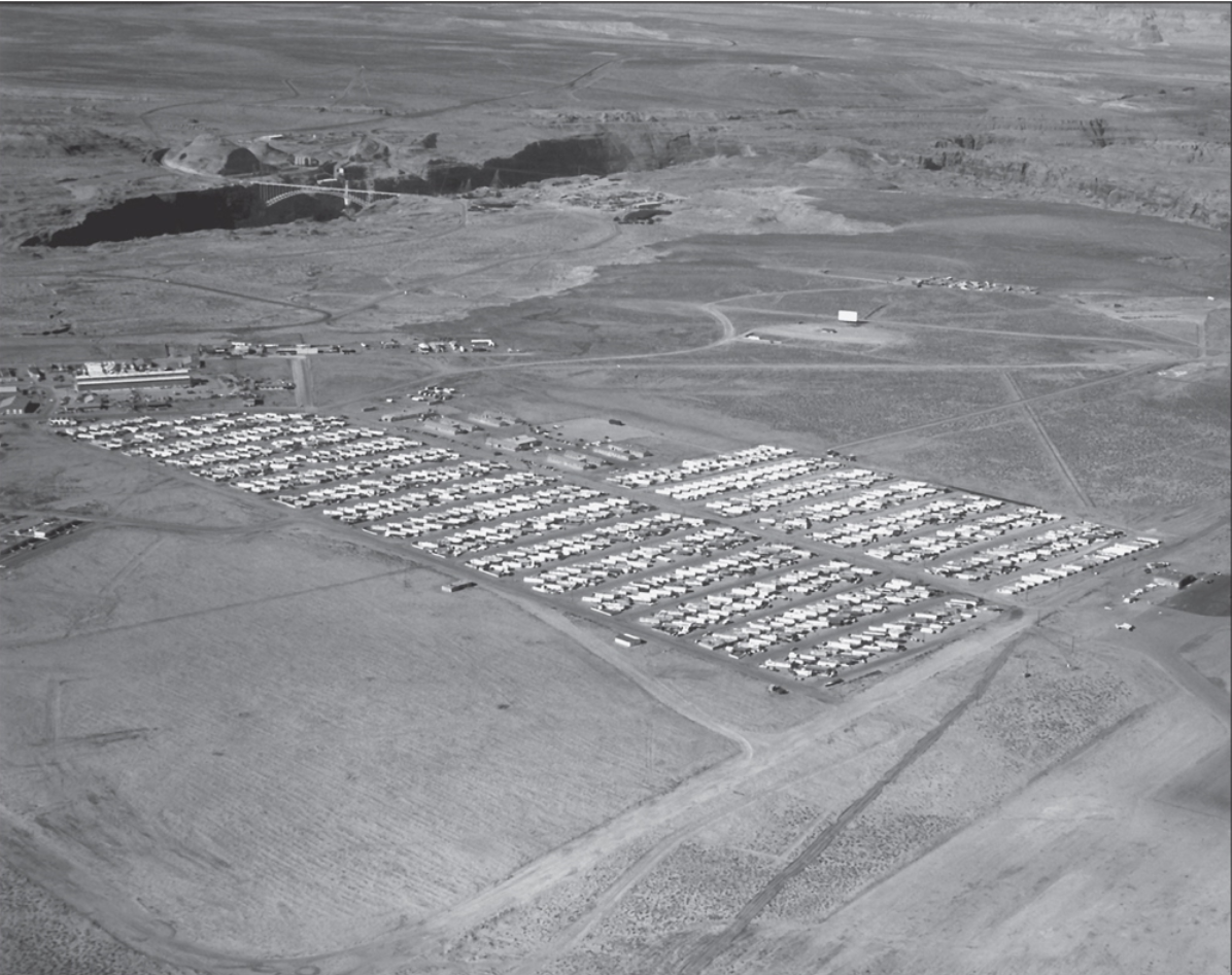
Here’s a great shot of the Page Trailer Court dated 12-14-60. Click on it to zoom in and scroll to the far right. Do you see the trailer sitting at an angle behind the airport hanger? That was our trailer. Yea!!! I finally found a picture of it to prove I existed. You’ll also see the drive-in theatre screen and the corrals in the background. The trailer court eventually expanded to include more streets/trailers on the left side of the court, similar to the expansion you see already in place on the right side. At the far left of the photo, you’ll notice a couple of the MCS apartments.
Here’s an 8mm YouTube home movie I came across with some excellent shots of the construction of Glen Canyon Dam, Glen Canyon Bridge, and Page Arizona from the late 1950s. This video captures some great moments of that time. Enjoy!
Photo: USBR. P557-427-159 NA. April 22, 1971. Signed by Jack Reinhold. My Source: Tim McDaniels
This photo captures a time in Page that I remember well. Click on it to enlarge and zoom in. There are some things worth noting. First, this was taken in 1971 at a time when Bechtel was coming into town to build Navajo Generating Station (NGS). The time between the completion of Glen Canyon Dam in 1964 until movement started on NGS construction in the very late 60s/early 70s, saw the population of Page dwindle considerably. I remember many, if not most, of the USBR houses and MCS apartments sat empty for a number of years from 1964ish to 1970ish.
The photo above shows the abandoned MCS trailer park as it was being re-populated with the coming of Bechtel and its associated trades. Our trailer site is long gone in this picture but the tree that was near our front yard is still there at the top right corner of the picture, behind the airport hanger. This is a good aerial shot of the Empire House, Page Club Restaurant, Sportsman Headquarters, Pink Sans, and a few of the early gas stations. Is that the Teen Canteen still standing near the curve of the old dirt road between the MCS Apartments and the trailer court? I’m not 100% sure, but it could be.
The original business district foundation slab is still visible on the left edge of the photo, near where present-day STIX Market is. That was where the original Babbitt’s, the bank, barber shop, et al, were located. You might remember Redd’s Bottle Stop being to the left of that slab along what was then, 7th Avenue. The concrete slab that was an outdoor movie screen and dance floor is still there in this picture, located behind Keisling’s gas station. If I remember correctly, the white rectangle building set back from 7th Avenue near the left edge of the photo and near the old Babbitt’s slab, was the Dairy Queen. The building in front of it, that’s only partially visible, was DeWitt’s Kentucky Fried Chicken. I was a cook there for a time during High School. Mr. Dewitt was not only one of my teachers, but my boss. Talk about pressure! 🙂
I came across this video showing some good footage of the Glen Canyon Dam construction as well as some great shots of early Page Arizona. Some of the narration gets a little cheesy but the footage is amazing. You may even recognize some of the faces. I was surprised to see Chet Huntley narrating it. After the first minute and half to two minutes in, it picks up and gets good. The total length is only 27 minutes.
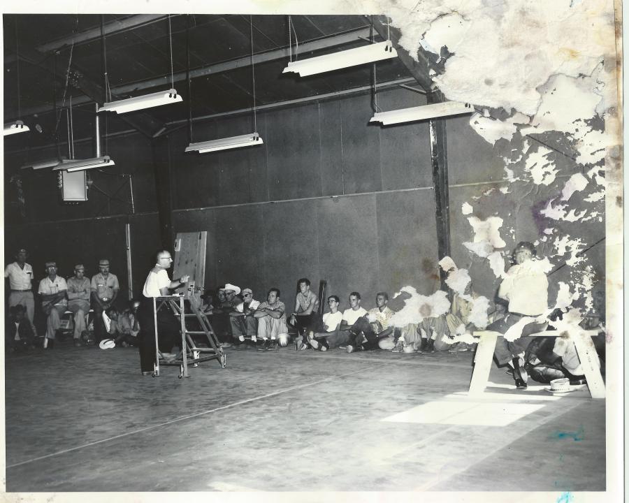
I’m glad I was able to scan this photo before there was any more water damage. I’m not sure what this meeting was about, or where it occurred for sure. There was nothing written on the back. Was this inside the USBR warehouse? Are you in this picture? Do you recognize anyone in it? Please leave me a comment if you do.
Here’s a look back and a reminder of how Page looked in those early days. Most of these photos are scattered throughout other posts but I wanted to get them into the same post, so here they are!
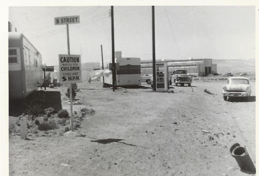
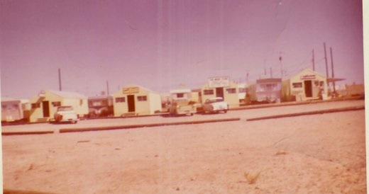
This is in the MCS trailer court at the corner of B Street and what is today, Aero Ave, looking northwest. The USBR warehouse is in the distance.
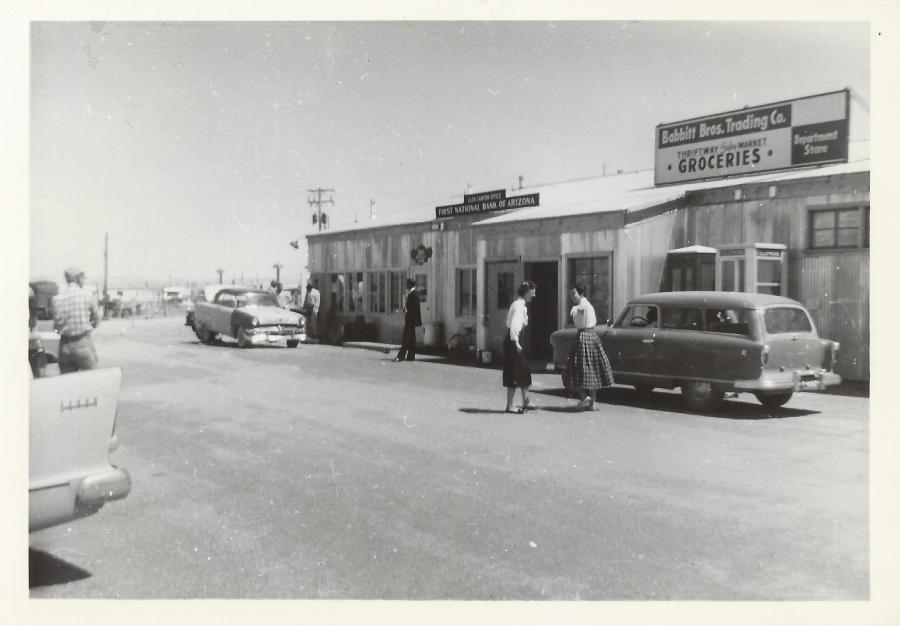
1957 Page Business District. Donna Taylor (the first graduate of PHS) and Petey Lloyd Dietz talking in front of Babbitt’s. This building was located behind present-day Stix Market. The MCS Trailer Court is visible in the background. Photo courtesy of Petey Lloyd Dietz.
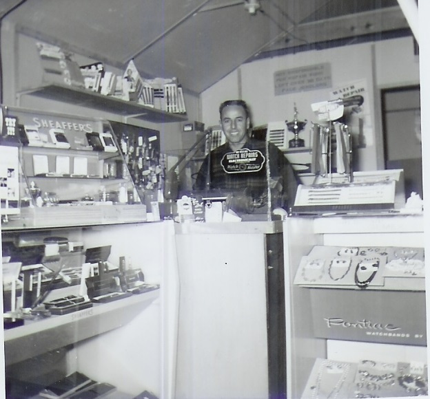
Ernie Severino inside the original Page Jewelers. Photo courtesy of Ernie Severino Jr. Undated.
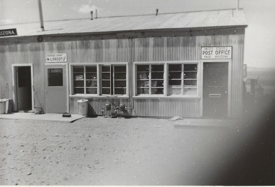
Here’s a shot of the old Barber Shop and Post Office. The sign on the barber shop door says there were 3 barbers at that time. I only remember Hank. Photo courtesy of Petey Lloyd Dietz. Undated.
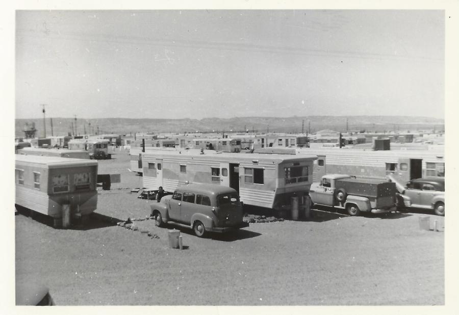
Here’s a nice view of the MCS Trailer Court. Photo courtesy of Petey Lloyd Dietz. Undated.
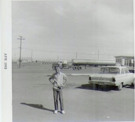
Mike Severino in front of present-day Lake Powell BLVD. That’s Keisling’s service station on the right. Photo Courtesy of Ernie Severino Jr. April, 1962
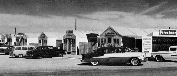
These huts housed a handful of Page businesses in those early years. Most (if not all) of the business owners lived in trailers next to their store as seen in this photo. These buildings were along North Navajo Drive opposite the USBR warehouse. Babbitt’s, the bank, etc were located to the right of this picture. Photo courtesy of Ernie Severino Jr. Undated.
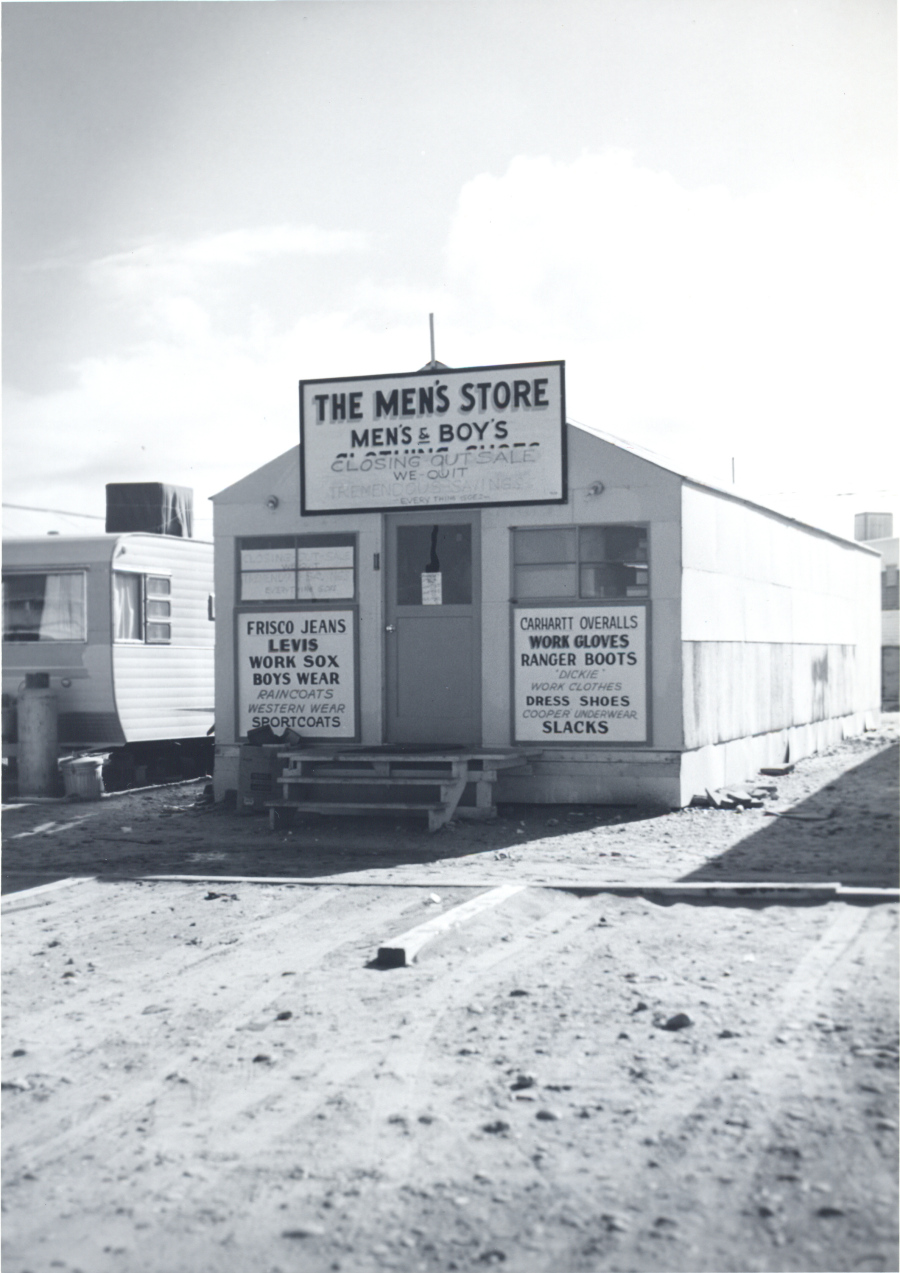
One of those early businesses was The Men’s Store. The closing of this store may have coincided with the strike in 1959. If anyone can confirm or deny that, please let me know. Photo courtesy of USBR. Undated.
Another perspective on the old business huts that were along North Navajo Drive. If I remember right, Firestone was owned by the Warners. You can zoom in to see the other signs. Photo courtesy of Terry Edwards. There is no specific date but it was late 50s or very early 60s.
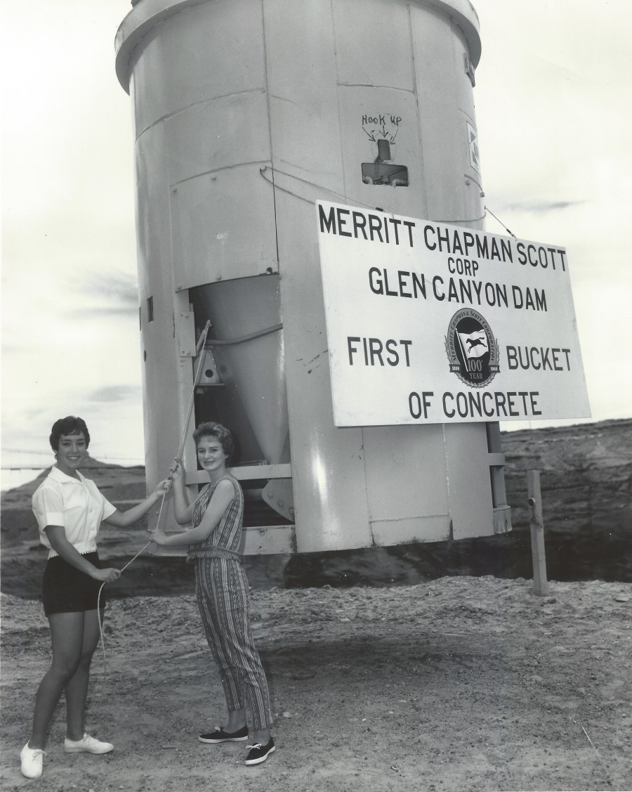
Photo: A. E. Turner, USBR. Linda Farris and Petey Lloyd Dietz and a really big bucket. Photo courtesy of Petey Lloyd Dietz.
This photo of Petey Lloyd Dietz and Linda Farris is amazing and it’s one of my faves! The back of the photo reads:
“P-557-420-4905, Glen Canyon Dam. Petey Lloyd and Linda Farris demonstrate the procedure for releasing concrete from the giant 12-cubic-yard capacity concrete bucket. They show how Secretary of the Interior Fred A Seaton will pull the lanyard and trip the first bucket of concrete on June 17, 1960. 5/26/60, Bureau of Reclamation Photo by: A.E. Turner”
Petey told me, “P.S., Our father, Lewis H. Lloyd, was the (first) concrete superintendent on the dam from 1957 – 1963. Perhaps I had a little ‘in’ on being selected for this photo.” 🙂
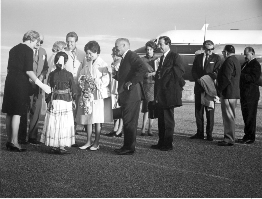
Photo courtesy USBR. November 13, 1965. Source: Terry Edwards
On November 13, 1965, Princess Margaret and Lord Snowdon arrived in Page where they were greeted by approximately 500 residents. They stayed at the Lake Powell Motel that was located on Highway 89, but has since been torn down. L-R in the photo above: Dora Knight; U.S Ambassador to the UK, Lewis Williams Douglas (more info); Rosalind Acothley (in traditional Navajo dress, with her back to the camera); Lord Snowdon; Princess Margaret; and Royce Knight. Art and Bill Greene are the two men at the far right of the photo.
Here are some other sources you might be interested in concerning this visit:
Both pictures are included in this e-book on Page and Lake Powell. Here’s a link to the preview. I purchased this book and am enjoying it. See the preview.