Page Jewelers

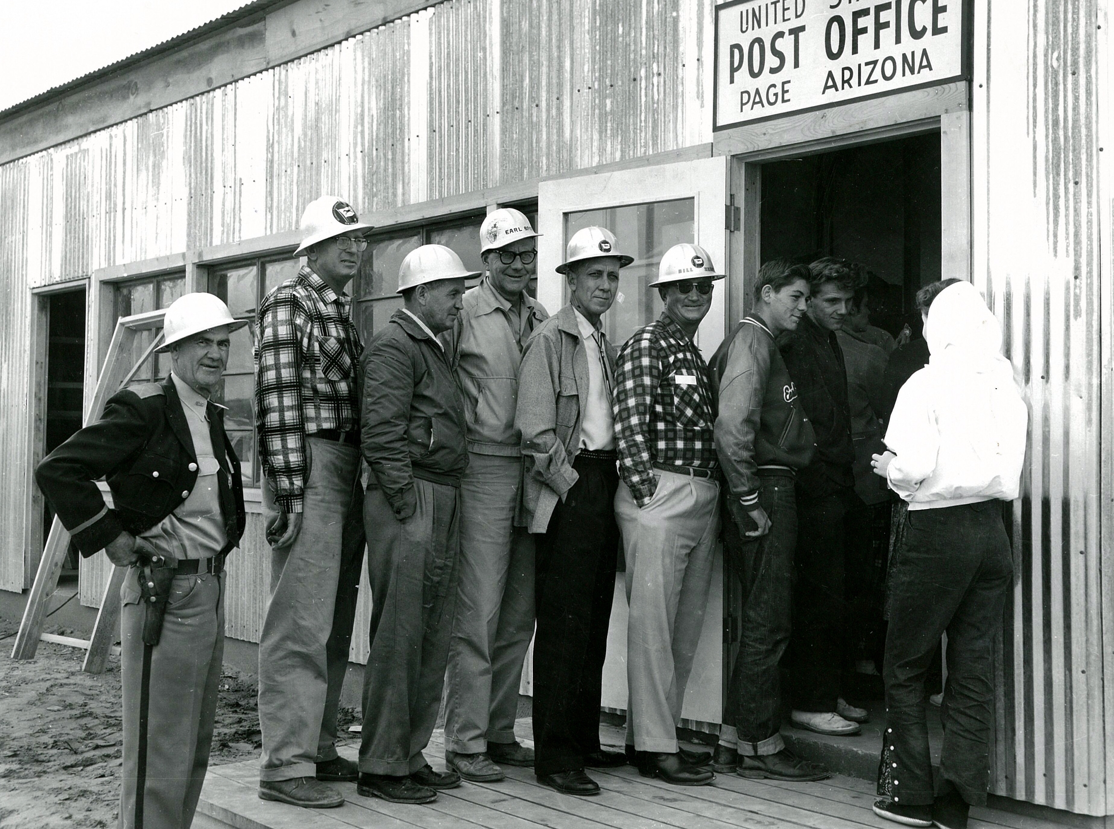
Photo Courtesy of Terry Edwards. Page Jewelers Original Store. Undated. Is the customer USBR photographer A. E. Turner?

Hey Peeps, I’m sorry it’s been so long since my last post. I guess I have a life after all. In my last post, way back in March, I promised my next few posts would be of the businesses in those small white buildings along North Navajo Drive. If you need a refresher, go back and read that post and then come back here.

In this post, we’re going to talk about Page Jewelers, one of those businesses. It was owned and run by Ernie Severino. The photo above shows him inside the original store located among other business trailers along North Navajo Drive. Does anyone recognize the customer? Is it USBR photographer A. E. Turner? Ernie Jr wrote me after I sent this picture to him and said,

“That chair is outside my shop, I use it all the time. I also see the machine that he used to clean watch parts, it’s in my shop too. Just can’t give it up!”

He gave me permission to share that with you. Thanks Ernie! He also gave me some good info on the layout of these businesses and the trailers there. He told me,

“At least that’s what we called them [The Shacks]. Starting at the left was our trailer, then Page Jewelers, and Kerry and Sonia Jones’ trailer, and then the shoe store, and then Bob Jorgenson’s (I’m pretty sure that was his name) trailer, and then his shop. The Men’s Store, and then the Firestone Store.

 “There was a store next to our trailer, I think you mentioned it and said something about a Key Shop, I remember it as a place that sold carpet and floor covering it was owned by Bud Lippert. He had a son close to my age named Dennis.

 “Then the next shack was Bill Lee’s restaurant I don’t know if it was called The Steak House at that point. I think it was a triple wide shack. It caught on fire during the middle of the night. A night I’ll never forget, luckily there was Continue reading
1959 Aerial Photo of Page, Arizona

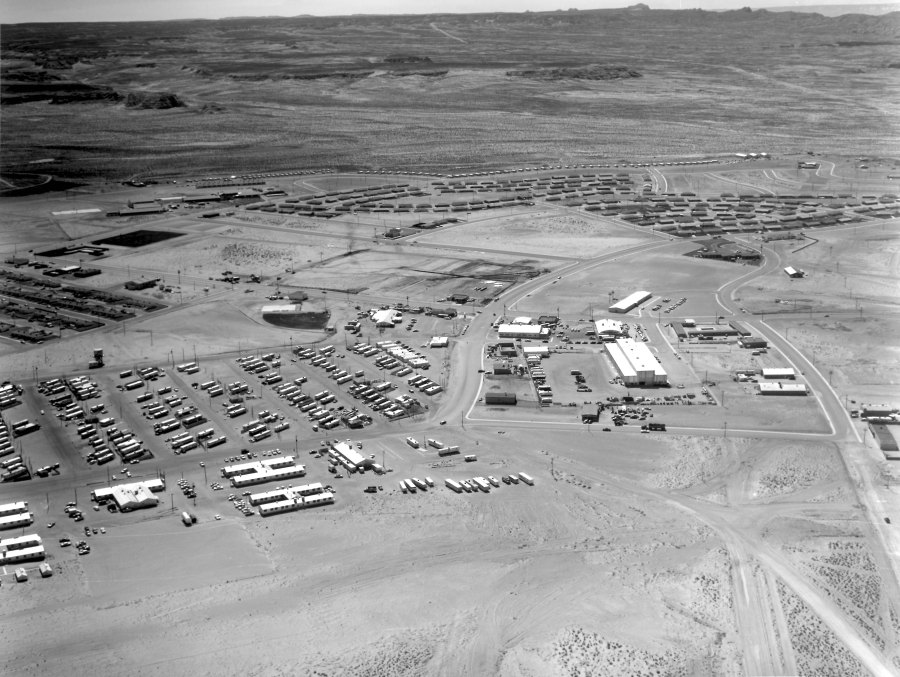
1959 Aerial View of Page, Arizona. Photo Courtesy of Terry Edwards.

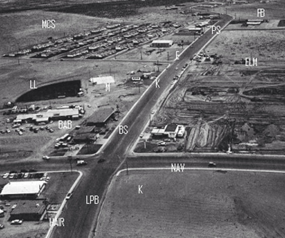
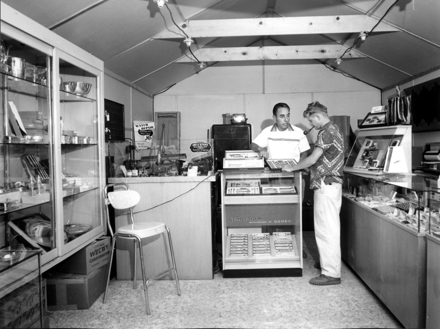
Some of my favorite early pics of Page and the surrounding area are these old black and white aerial shots. You can see a lot of detail and they always bring back memories of what it was like. One of the reasons I’m posting this one is because in my next post or two, I’ll be highlighting some early businesses and I want you to have a reference point for their location if you’re not familiar with it.

We have a lot to talk about in this photo. Click on it to open it up and you’ll be able to zoom in. Let’s start on the right side, as you come into town on 7th Avenue. The Glen Canyon Steak House and Motel aren’t there yet, but it looks like the ground is being cleared for their construction. To the right, along Vista Ave., you get a good look at the Page Hospital and what was at that time, the USBR offices. You can see a close-up of that building and read more about it HERE. You can also see/read more about the hospital HERE. Okay, back to our journey up 7th Avenue. The next building on the left is the Page Boy Motel. The building across the street was the Vostron building and now houses the City of Page offices.

The building across from Vostron on this side of 7th Avenue is the bowling alley. The big rectangle building just this side of the bowling alley is the USBR warehouse. The white rectangle building to the left of the bowling alley in this photo was (is?) the fire station. The smaller building that’s attached to the right end of the fire station was the USBR Ranger station. The only thing I remember being in the Continue reading

Below The Coffer Dam

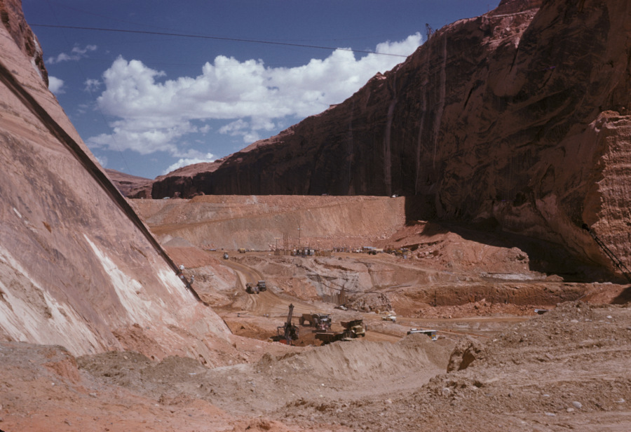
Photo: USBR. July, 1959. Courtesy of Terry Edwards.

I love the detail in these old USBR photos. If you zoom in on them, you can see some pretty cool stuff. This one is no exception. It gives us a good downstream look at the temporary coffer dam. You are looking upstream toward what would eventually become Lake Powell. The coffer dam was built to divert the Colorado River water into the two spillway tunnels that routed the water through the canyon walls to the downstream side of the dam site. The right side tunnel (the Visitor Center side) was the primary tunnel and it handled most of the diversion water.

The excavation going on in this picture is prep work for laying the base of the dam. I remember reading or hearing somewhere that the base concrete for Glen Canyon Dam was poured 135 feet below bedrock. This picture captures that excavation. Some of the dirt and rock that was Continue reading

Not Norman Rockwell

Source: Terry Edwards Date and Photographer Unknown
Source: Terry Edwards
Date and Photographer Unknown

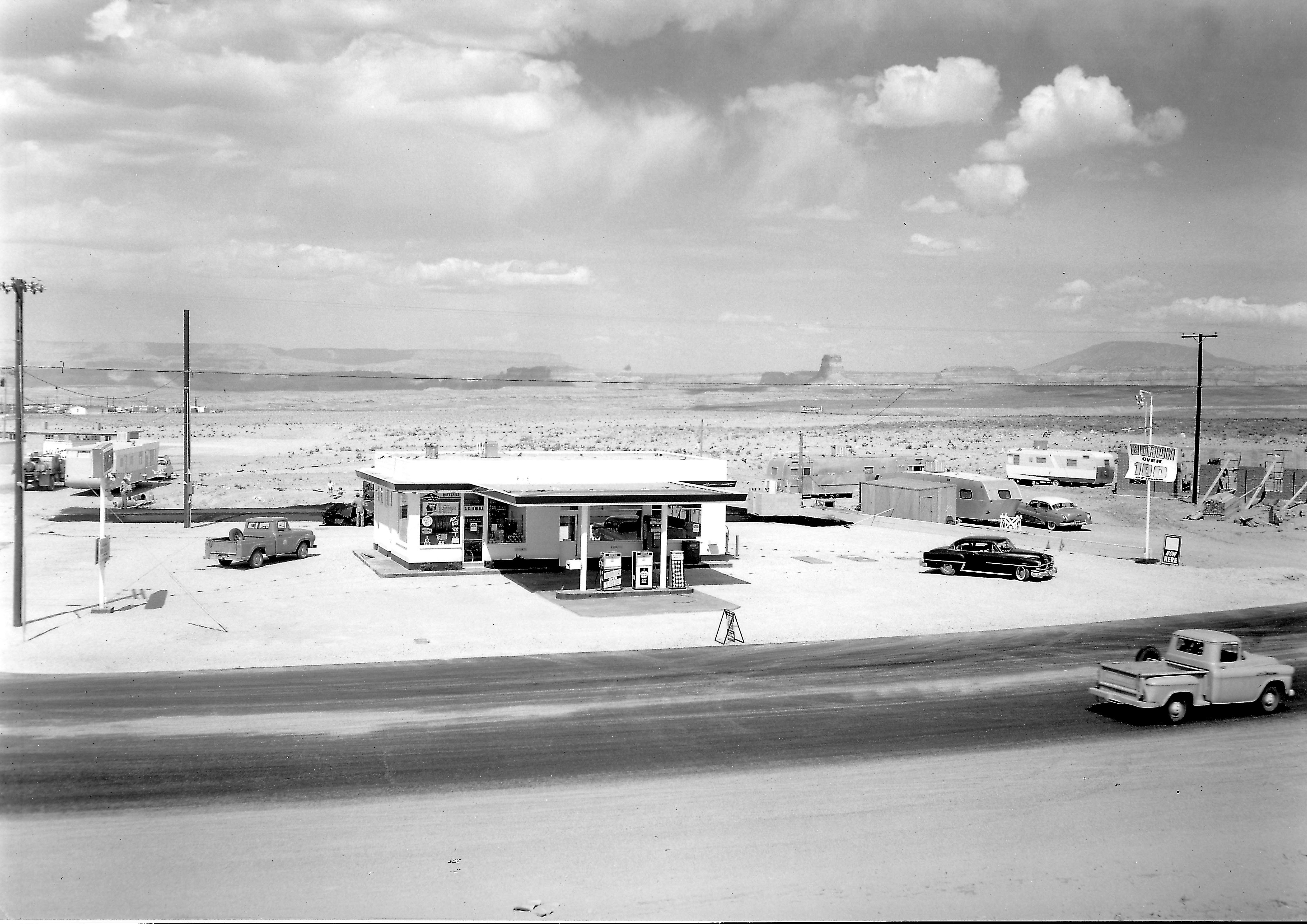
This first picture looks like something out of a Normal Rockwell painting. My first thought was that it was the original Exxon (Enco) gas station on the corner of 7th Avenue and Elm, but the wall under construction on the right side of the photo would have to be the Empire House, and that’s not the Empire House. Plus, other pictures of the old Exxon station show a completely different layout with two garage bays on the left side of the building. That’s how I remember it.

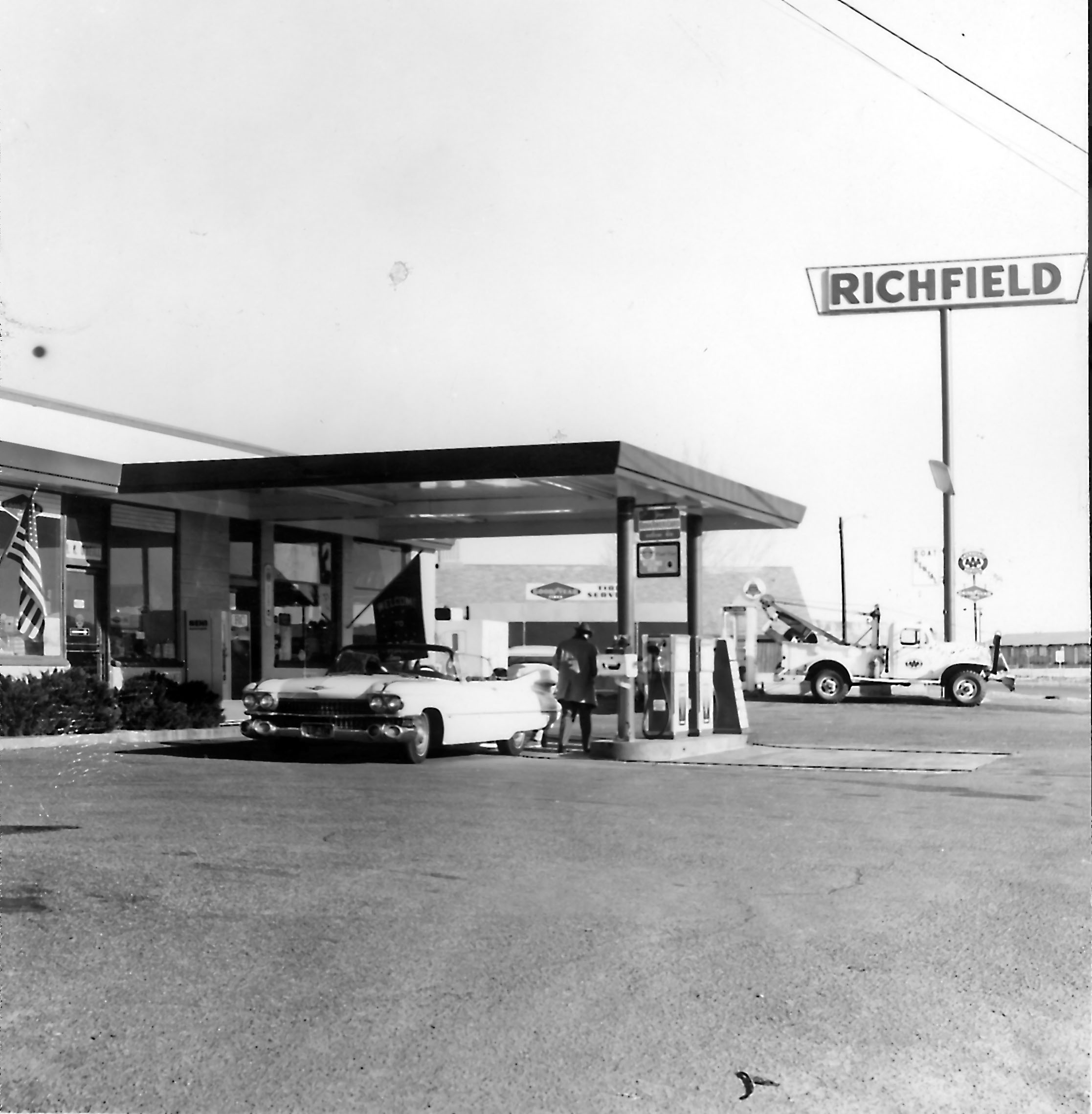
After digging a little further, I realized this is the old Richfield station that was on the corner of South Navajo and 7th Avenue (Lake Powell BLVD). You can see 7th Avenue starting to curve toward church row. The building under construction on the right is the First Baptist Church. The last time I was in Page, this gas station had been turned into a fast food restaurant. The quality of this photo is amazing. So are the two pickup trucks! The MCS apartments are visible on the left behind the small trailers. It looks like they’re under construction. The white building further back is probably the American Legion building and beyond that, the original trailer court. This is a good shot of Tower Butte and Navajo Mountain in the background. I’m not sure what that billboard says in the background. Even zoomed in, I can’t read it.

The bottom picture is of the same building some time later. I wonder if the Cadillac was pink. Neither picture is dated and I don’t know who the photographer was.

Source: Terry Edwards Date and Photographer Unknown
Source: Terry Edwards
Date and Photographer Unknown

-Mike

First Things First

First Buildings
Photo: USBR, date and photographer unknown.
Source: Terry Edwards

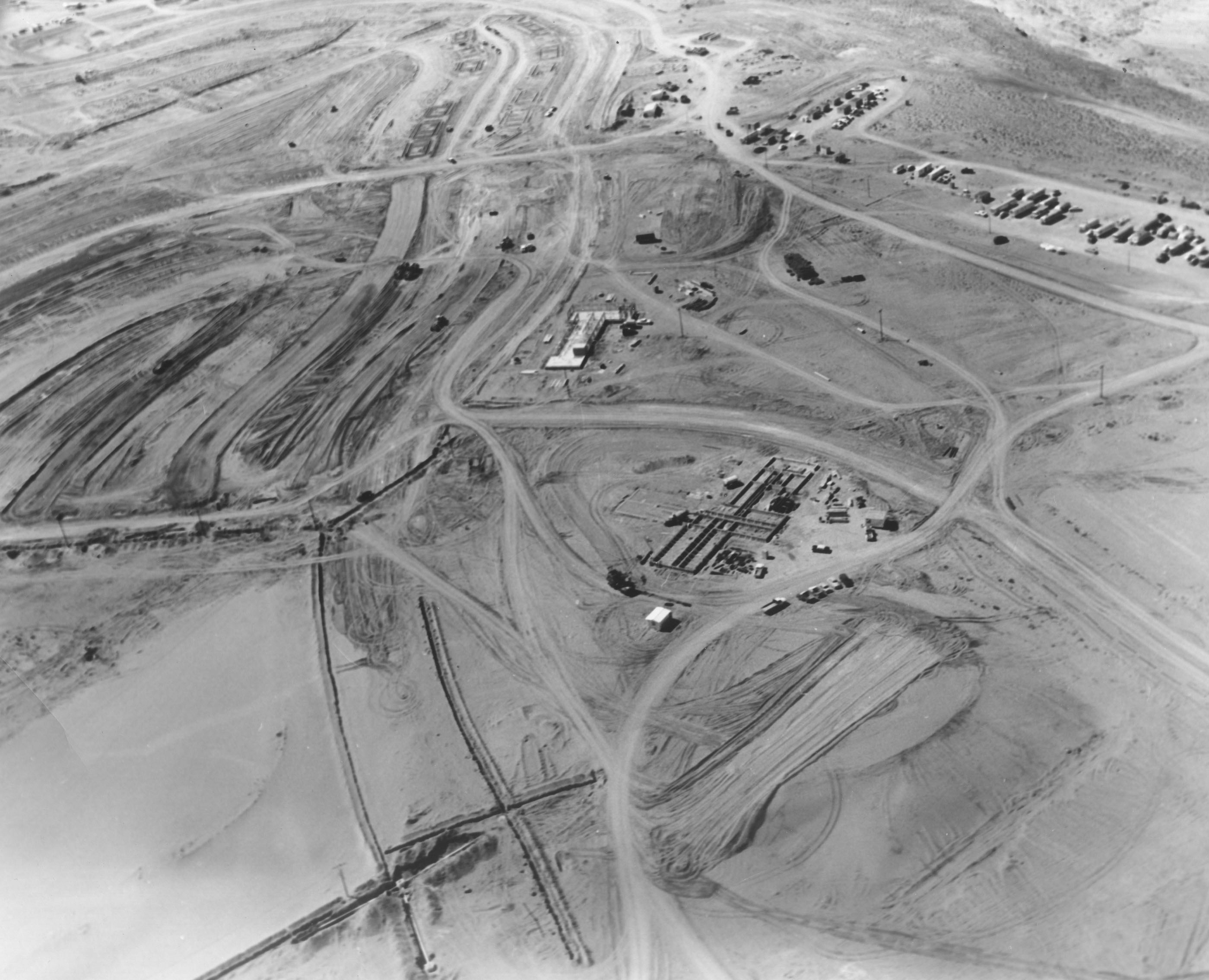
It took me a few minutes to figure this one out, but I eventually did. I’m not the sharpest knife in the drawer, so that explains a lot. This first pic is an early shot of two of the first buildings that went up in Page, if not THE first two.

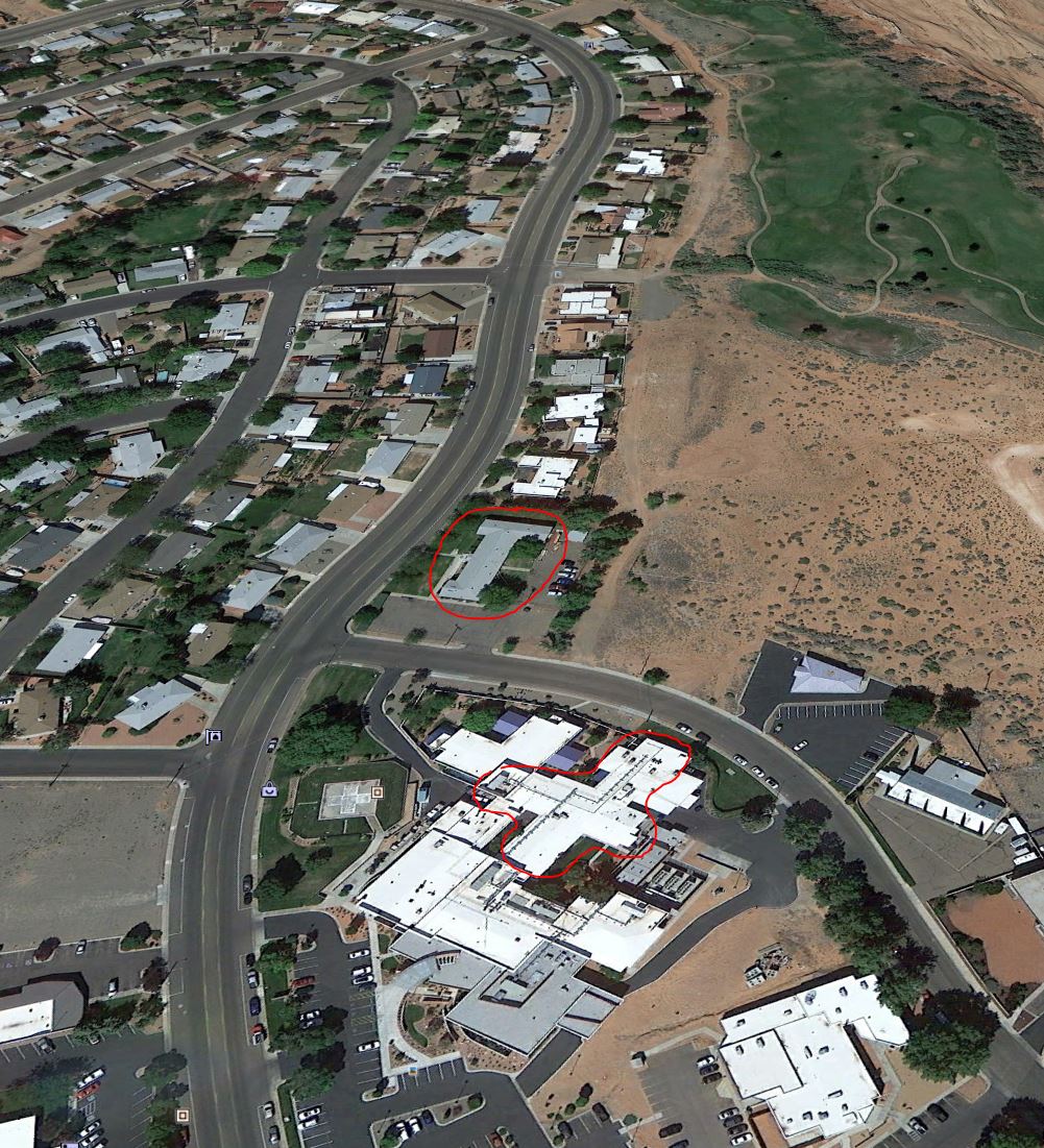
There weren’t any landmarks in the picture to go by, so it kind of leaves you on your own. Give up? This is the corner of Vista Ave and North Navajo Drive. The larger building is the hospital and the smaller building originally served as the USBR admin building. It’s been a number of other things since then. I talked about it and shared a really nice photo of it with you in a previous post [HERE]. Be sure to click that link if you haven’t already seen it. It’s worth the click! The dirt road between the two buildings is Vista Ave. The nicely graded road to the left is Gum Street. For reference (and because I have awesome moments) the picture below is how that same area looks today. I rotated it to match the angle of the picture above as much as possible, and I circled the same two buildings. The hospital’s grown from it’s original size, so the area I circled is the original footprint of the building.

Page Now
The same two buildings are circled in red.

Enjoy!

-Mike

7th Avenue From The Air

Here’s an aerial shot of Page giving us a good look at 7th Avenue (now Lake Powell BLVD) and some of the early town construction. It’s undated, but 1960-61 is a good guess. I’ve had this photo for a long time and I don’t remember where I got it for sure (maybe Brian Keisling) and I’ve never known who took it or who marked up the different locations. But those are helpful, so let’s run through them.

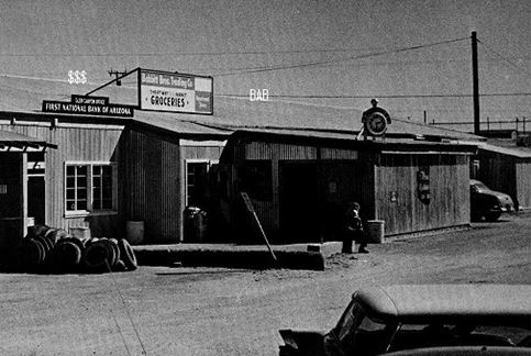
LPB is Lake Powell BLVD (7th Ave). HAIR was the barber shop. I’m assuming the barber was Hank. Does anybody remember him? The barber shop eventually moved to the plaza near the theatre. That plaza isn’t built yet in this picture. K is the present location of the Circle K and NAV is North Navajo Drive. The unmarked building on the corner above North Navajo was a Gulf gas station. We used to ride our bikes there and fill up gas cans for my friend’s mini bike and our golf cart. The building marked BS isn’t a reference to a crappy building, but is referring to Redd’s Bottle Stop. It’s now the location of Stix Market. BAB is referring to Babbitt’s. First National Bank was also in that building. I’m putting a picture of that building below to give you a better look. LL was the Little League field.  M is referring to the outdoor movie screen. K is a reference to Keisling’s gas station. You can see that Elm Street hasn’t been built yet on the right side of LPB. E is referring to the old Empire House. The last time I was in Page, that had become something else but I don’t remember now what it is. My first job as a teenager was as a busboy at the Empire House and my mom was one of the cashiers there for years. MCS is referring to the MCS apartments. PS is the Pink Sans. FB is the future site of the football field. It looks like it’s not there yet in this picture. The buildings just below FB must be the Manson Mesa pool.  You’ll notice South Navajo isn’t there yet either, but you can see part of the park to the right if the pool.  I think the dark line below the pool and the park is a fence. When I first saw this picture, I thought it was a road that is no longer there. But looking closer, I don’t see a break in the curb along LPB, so I’m pretty sure it was one of the many fences put up all over the place to stop blowing sand. They didn’t work too good. Looking along church row, you can see a few churches springing up, along with the teacher’s apartments on the opposite side of the road.

The picture below is a closer look at Babbitt’s and First National Bank, located in the building in the above picture behind The Bottle Stop (Stix Market).

-Mike

Page Market

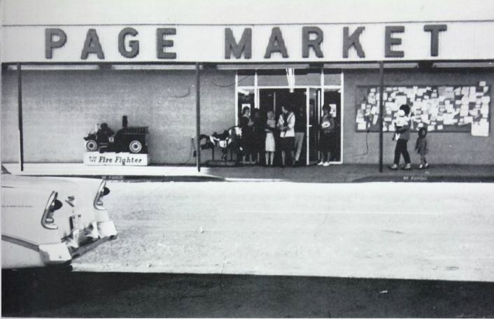
Page Market 1961
Page Market, 1961
Source: Unknown

Roueche’s Page Market stood adjacent to the Page Post Office in the plaza on the north side of Elm Street. I believe the post office is still there. In this photo, the post office is just off the picture to the right. These were adjacent businesses in one continuous building. Page Market was the only competition in town at the time to Babbitt’s Thriftway. Since the closing of Page Market (I don’t remember what year that was), several other businesses have occupied this space, but the one I remember most was Yellow Front/Checker Auto. I’m not sure what’s there now.

When I was a little tyke, probably about the time of this photo, I remember being in Page Market during a torrential rainstorm with my mom. We were at one of the checkout counters when the wall between Page Market and the post office moved a little and water started pouring in the Page Market side from the top of the wall. I remember my mom picking me up and putting me on the counter. I don’t remember what happened next, but I’m still alive so I guess it had a happy ending, at least for me. Oh, and several years later I found a $20 bill just outside the other set of doors that were around the corner to the left of this picture. If that was yours, so sorry. But finders-keepers.  I also remember that crowded bulletin board. It was Page’s early version of Craig’s List.

-Mike

Hamburgers and Hotdogs

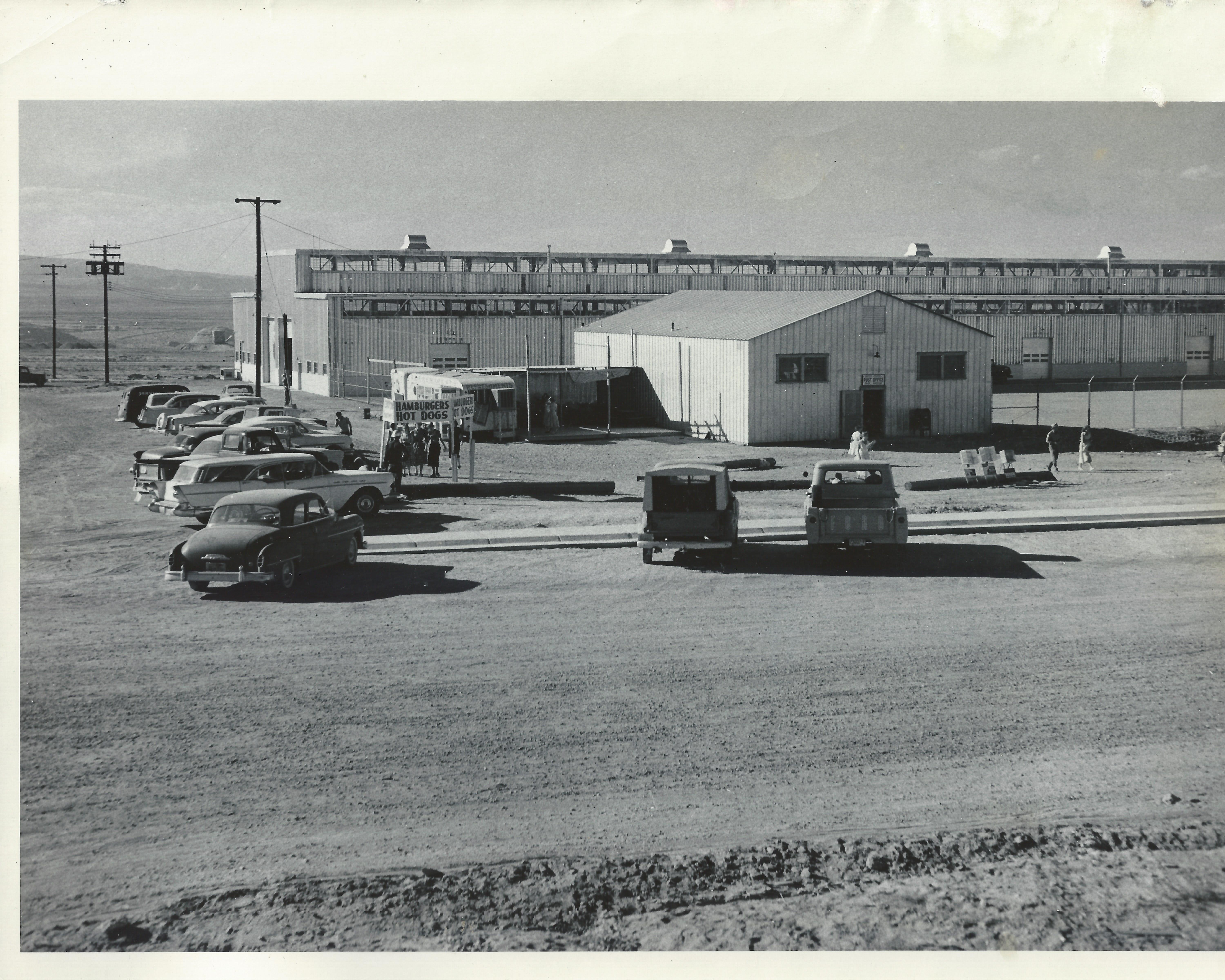
Photo: J. L. Digby, USBR 10/6/1958 Courtesy of the LeGate family.
Photo: J. L. Digby, USBR
10/6/1958
Courtesy of the LeGate family.

This picture, dated 1/6/1958 is another view of the post office with the USBR warehouse behind it. The warehouse is still there, but this post office is long gone. The Windy Mesa was eventually built just to the right of where this post office sat, on North Navajo Drive. This picture was taken from the approximate location of present day Stromboli’s. The fire station and old USBR ranger station were to the left of this picture. I did a separate post about this post office building [HERE]. Now I know where it was located.

I’m not sure if the hamburger and hotdog stand was a regular event, or if there was something special going on this day.

-Mike

1958 Post Office

image
Page Arizona Post Office 1958. Source: LeGate Family

This amazing picture was sent to me yesterday by a friend (thank you Gene!). I don’t know who took it or why, but it’s one of my favorites. It’s the Page Post Office in 1958. This was taken 1 1/2 to 2 years before we moved there and I don’t recognize anyone in it. I think it’s interesting that the young guys are talking to the girl, but the older guys are all about the camera, except that one guy. There’s always that one guy.

This building was located next to the USBR warehouse on North Navajo. across the street from present day Stromboli’s. I am curious to know why there was such a line out the door on this day. Nobody seems to have anything to mail. Maybe it was a rush on forever stamps or maybe there was free wifi.  But I doubt it.

-Mike