British Royalty Arrives in Page

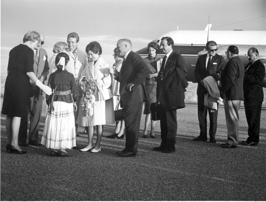
Photo courtesy USBR. November 13, 1965. Source: Terry Edwards

On November 13, 1965, Princess Margaret and Lord Snowdon arrived in Page where they were greeted by approximately 500 residents. They stayed at the Lake Powell Motel that was located on Highway 89, but has since been torn down. L-R in the photo above: Dora Knight; U.S Ambassador to the UK, Lewis Williams Douglas (more info); Rosalind Acothley (in traditional Navajo dress, with her back to the camera); Lord Snowdon; Princess Margaret; and Royce Knight. Art and Bill Greene are the two men at the far right of the photo.

Here are some other sources you might be interested in concerning this visit:

-Enjoy!

Glen Canyon Bridge Dedication

Photo: USBR. Glen Canyon Bridge Dedication, 1959. Source: Terry Edwards.

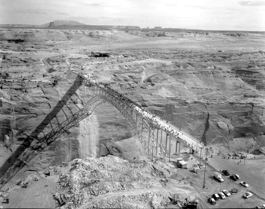
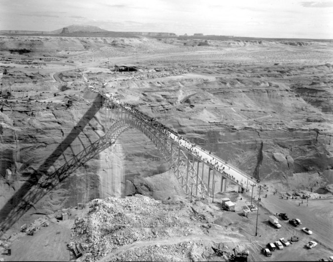
The dedication ceremony of Glen Canyon Bridge took place on Friday, February 20, 1959. My understanding of that event (we moved there shortly after the bridge was dedicated) is that the ribbon-cutting was actually a chain-cutting using a cutting torch and once the chains were cut, the crowds quickly moved onto the bridge to take a look below at the beginnings of Glen Canyon Dam. These pictures capture some of that day. If you were there, I’d love to hear your story in the comments.

The photo above is taken from above the beehive, looking back toward Page. If you click on the picture you’ll be able to zoom in and see the detail. Look at the number of cars parked on the Page side of the bridge and the line of cars still arriving on US89 in the distance. You can also see the original visitor’s lookout near the top of the canyon wall on the Page side of the canyon.
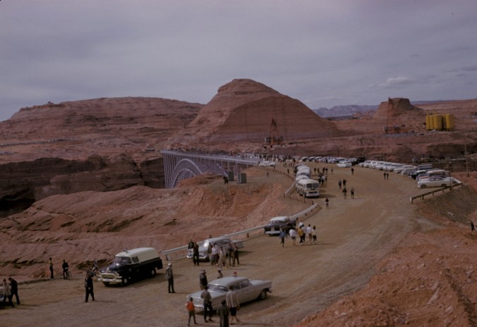
Photo: USBR. Glen Canyon Bridge Dedication, 1959. Source: Terry Edwards.

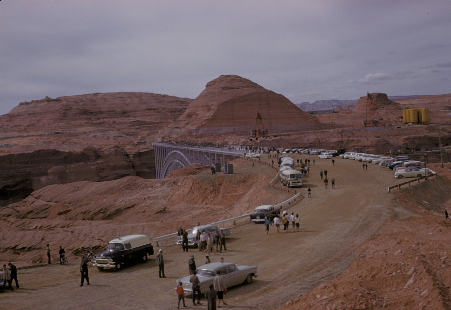
The photo above is a look from the Page side of the bridge. Check out the ambulance, the ’57 Chevy, and the old busses. The ambulance is visible in the first picture above by zooming into it.
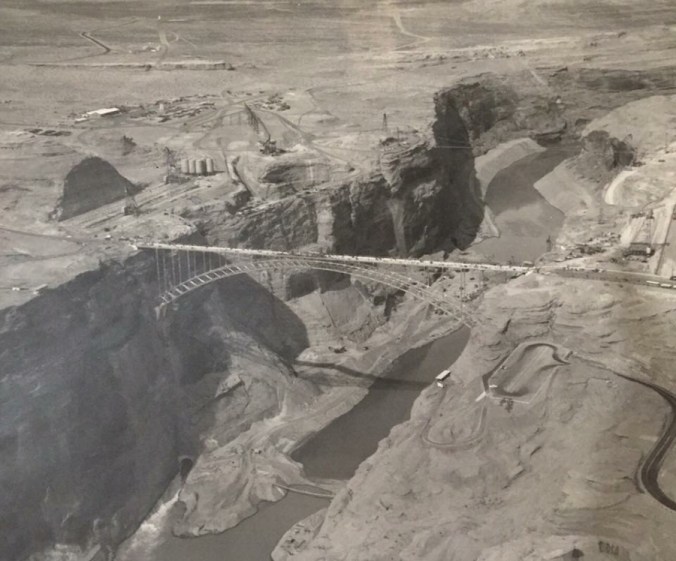
Photo: USBR. Glen Canyon Bridge Dedication, 1959.

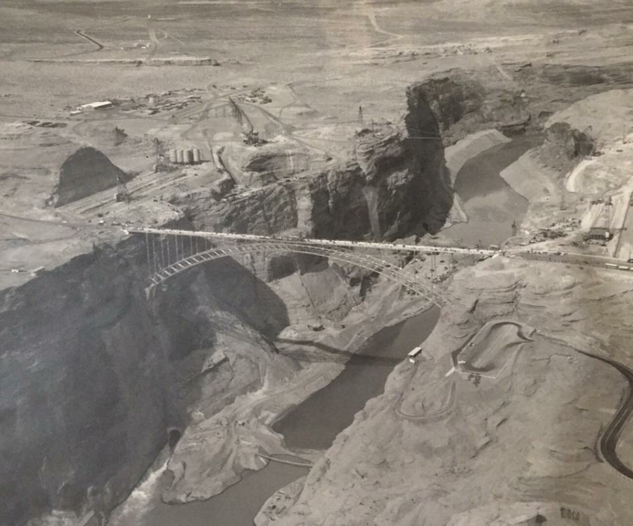
Click on the above photo and look at the detail. The parking lot on the right was for visitors and there was a walking path down to the lookout point that I mentioned in the first picture, also clearly visible in this photo. The buses in the previous photo are visible in this one, to the right of the bridge. The first visitor center would eventually be placed on US89 between where those busses are parked and the end of the bridge. Looking in the canyon, the ledge has been cut in the canyon wall for the concrete batch plant but it’s not there yet. You can also see the keyways are cut for where the dam would be anchored to the canyon walls.

The lower footbridge is visible near the bottom of the photo and the upper footbridge can be seen in the background. No dam yet, but it’s on its way. You can see water flowing through the right diversion tunnel. Right and left seem relative, but in previous photos, right and left are usually referenced from the upstream side of the dam, looking downstream.
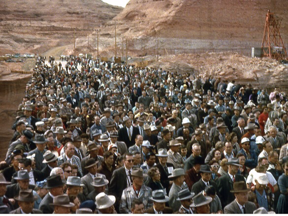
Photo: USBR. Glen Canyon Bridge Dedication, 1959.

The above photo is like the “Where’s Waldo” of bridge dedications. Are you in this picture, or do you recognize someone who is? If so, please leave a comment and let me know.
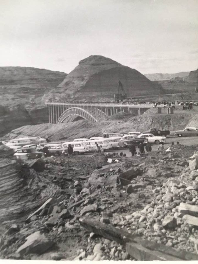
Photo: USBR. Glen Canyon Bridge Dedication, 1959. Source: Donna Bloxton Petersen

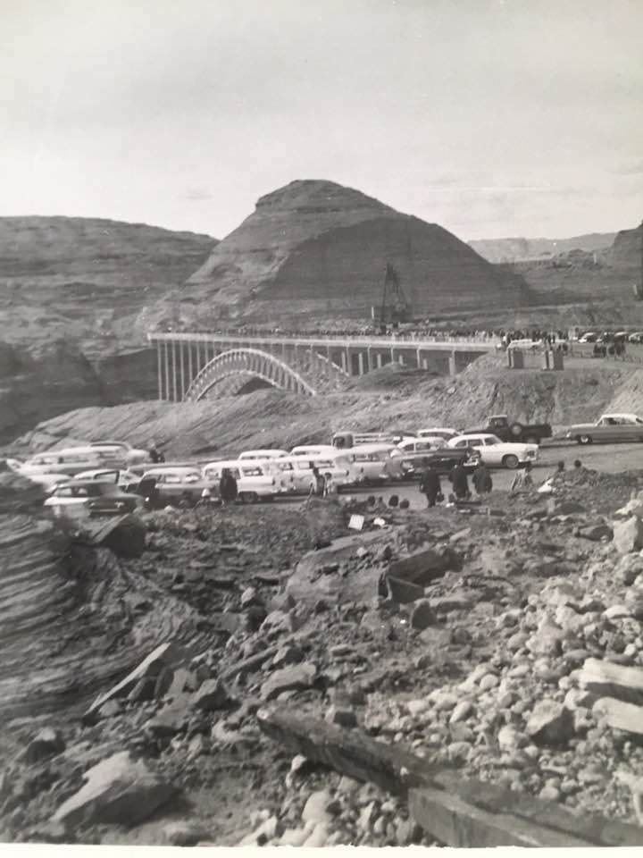
The photo above was sent to me by Donna Bloxton Petersen with this caption, “Glen Canyon Bridge Dedication or First Bucket of Concrete for GC Dam when Paul Fannin was Governor – by Donna Burgess Kielland” I’m going with the bridge dedication since there is only one crane tower built and it may not be completely built (two more were built on that side of the canyon). Those three cranes were used in conjunction with the three on the opposite side of the canyon to lower the concrete buckets (and other things) into the lower canyon.
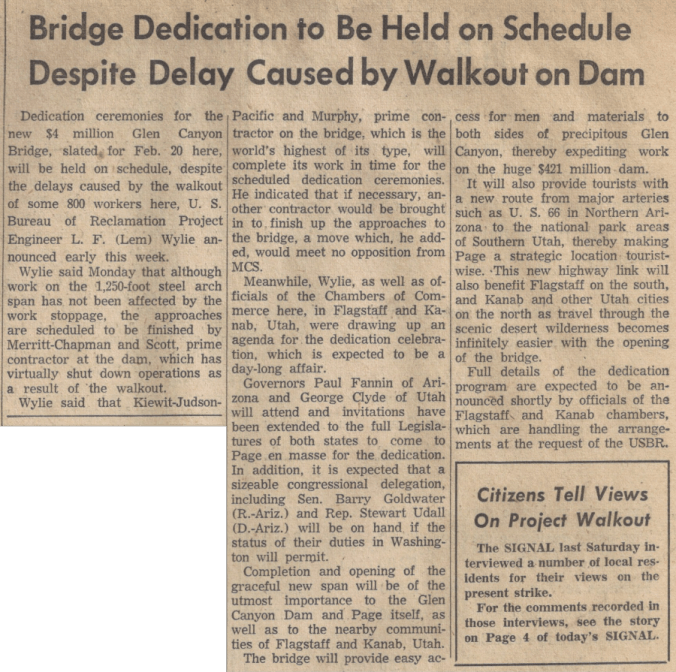
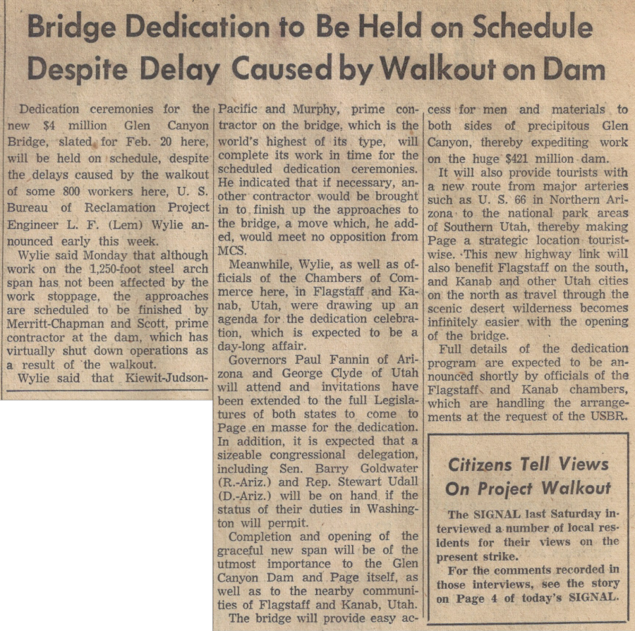
Source: Page Signal, February 4, 1959.
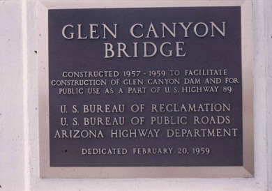
 

Photo: USBR. Glen Canyon Bridge Dedication, 1959.


Until next time… Enjoy and share!

Mike
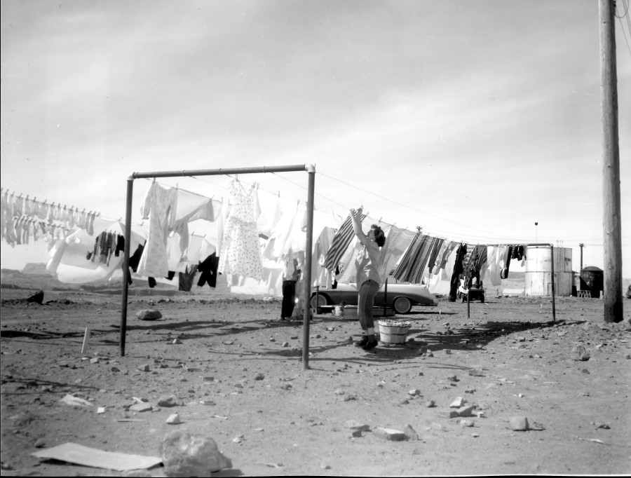
Airing Their Laundry

Photo: USBR. Undated. Source: Terry Edwards

This is a fantastic photo! It captures a true moment in the pioneering life of early Page. I’ve closely studied the details in this picture and I’ve concluded that this was taken from behind the transit homes, near South Navajo Drive and Aspen Street. If you click on the pic and open it, you can zoom in and take a look at some of the detail with me. Do you see the tanks on the right side of the image? You can get another look at them in THIS EARLIER POST of the transit homes to see what I’m referring to. In the picture above, the building to the left of the silver tank may be one of the Butler Buildings that housed the first school. Once zoomed in, you can see the canyon in the distance under the laundry. Also notice the second person hanging up clothes and what may be a little girl sitting by the car.

If you know who this woman is, please let me know.

-Mike

Country Club Living

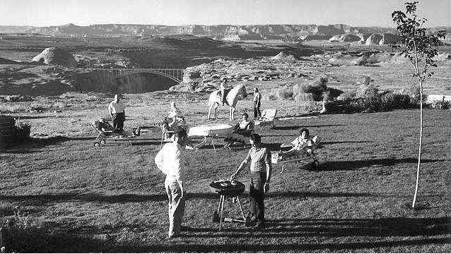
Undated and Unsourced. Royce & Dora Knight’s back yard?

This picture is undated and I don’t remember where I got it. I’m guessing it’s 1962-ish, based on the height of the dam and the fact it’s not visible yet. It gets pretty grainy when you zoom in, so I can’t make out any of the faces. But I think the guy in the white shirt standing in the back on the left could be Royce Knight. Just a guess. How about you? Do you recognize anyone? Check out the chaise lounge chairs. And that poor tree needs to be staked before the Page winds rip it out of the ground!

Enjoy!

A Few More Kicks on Route 66

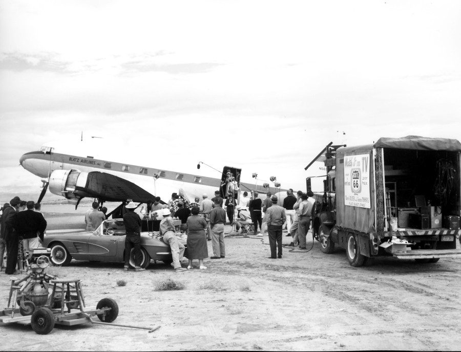
In 2013, I posted a blog about an episode of the old TV series, Route 66, being filmed in Page. You can see that post >HERE<. If Route 66 was before your time, it was a show about two guys – Tod (with one “d”) and Buz (with one “z”) – driving the old Route 66 in a cool Corvette Stingray and doing stuff. You may know Route 66 as Interstate 40. Season One, Episode Nine of Route 66 was filmed in Page and at the Glen Canyon Dam site when it was under construction. This episode aired on November 2, 1960 and was entitled, Layout at Glen Canyon. Construction on the dam was in its early stages and the bridge dedication took place the year before.

In this post, I want to tease out a little more trivia by way of some still images I made of the show while watching it. Some of these are little blurry but clear enough to see what’s going on. Enjoy!


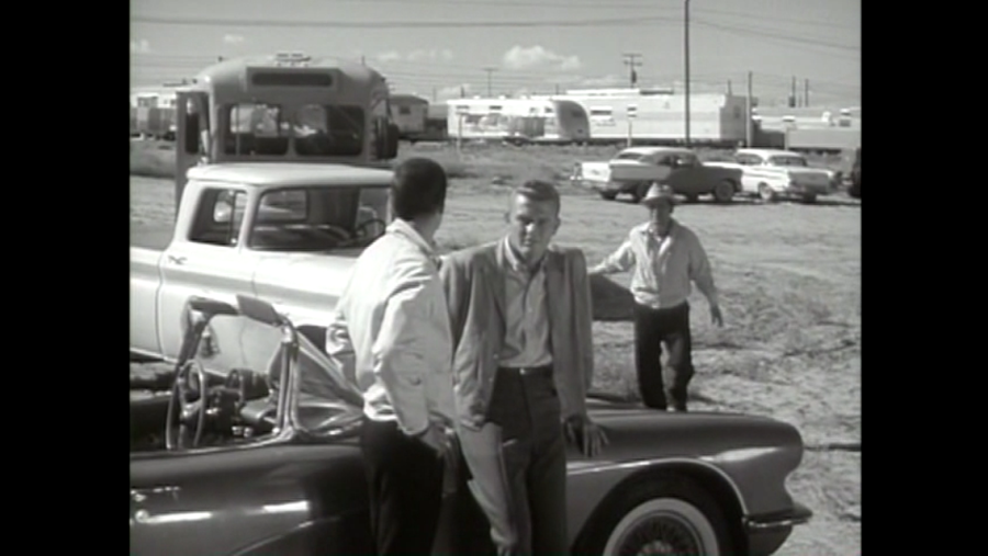
This first image above is one I used on the original post in 2013. They’re filming the scene where the women are getting off the plane. Click this image and enlarge it. Take a look at the all the details and notice the sign on the side of the truck. I’m not sure what the thing on the cart is. Careful leaning on that Corvette, people! We lived at the airport (literally) and this scene wasn’t too far from our trailer’s front door. But I don’t remember them making this show. Here are some stills from the show:


This early scene shows Tod (Martin Milner of Adam-12 fame) and Buz (George Maharis) in a deep discussion just before the models get on the bus to be escorted to where they are staying, which was a couple of trailers somewhere near where the “P” is painted along US89. You can see Manson Mesa in the background of the scenes filmed at those trailers if you watch the show. In the picture above, the line of trailers is P Street, the last street of the MCS trailer court, next to the airport. Our trailer was to the right of this picture right behind (literally!) the hanger. Here’s a wider shot of the same area:


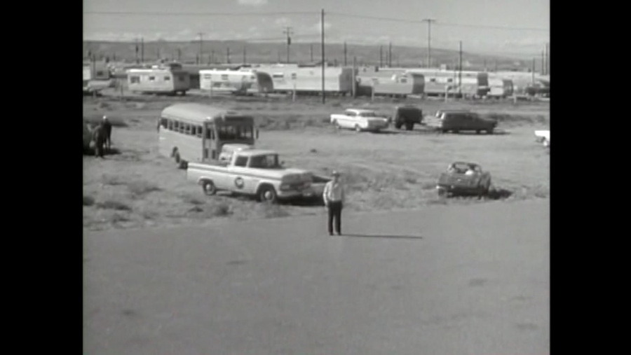
The picture above is a wider shot of the trailers behind the airport along P Street. The dirt driveway that Tod and Buz are headed to was the entrance off of P Street to the airport and the driveway to our trailer to the right of this picture. Here’s another action shot of the same scene: Continue reading

More Upper Footbridge Mania

The shortest distance between two points is a straight line. Here’s proof:

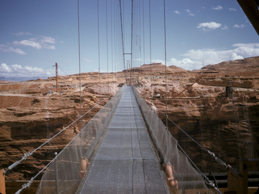
This shot of the footbridge was buried in a PowerPoint presentation that was sent to me a few years ago. It’s undated. Click on it to enlarge.

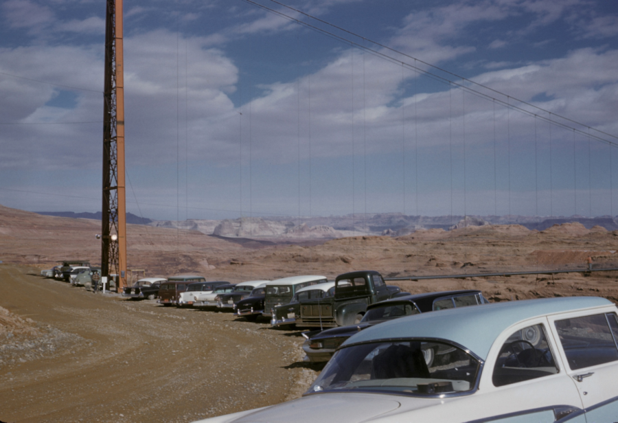
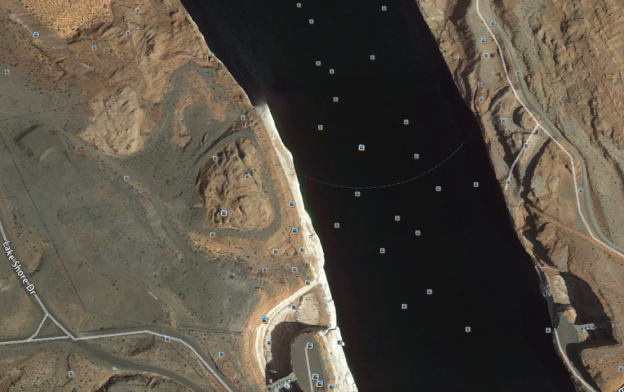
The photo above was taken from the west side of the canyon. Behind the photographer was a circular parking lot built around a small sandstone hill. The next photo shows the parking lot and the photo below it is an image I took today using Google Earth that shows the remnants of the circular parking area as it appears today. This temporary foot bridge spanned Glen Canyon and was located just upstream of Glen Canyon Dam.

Here’s a view of the parking area on the west side of the upper footbridge.

Here’s the image I captured this morning on Google Earth showing how the parking area appears today.

From Google Earth. The horseshoe-shaped parking area is wrapped around the sandstone hill on the west side of the canyon. The spillways are visible at the bottom of the photo.

I’ve written other posts about the upper footbridge. To see them all, type “footbridge” in the search box at the top of the page.

Enjoy!

-Mike

Movies, Movies, Movies

This shot looks like it was taken at Horseshoe Bend. Horseshoe Bend is off of highway US 89 just south of Page.

The area around Page has always been a prime location for movies and TV shows. The rugged and unusual terrain in the area makes it a unique spot for movie making. Here are a few of the movies/TV episodes I remember being filmed near Page:

  1. Route 66 Season 1, Episode 9, Layout at Glen Canyon (1960)
  2. The Greatest Story Ever Told (1965)
  3. Planet of the Apes (1968)
  4. Easy Rider (1969)
  5. The Outlaw Jose Wales (1976)
  6. Greatest Heroes of the Bible (1978) – A made for TV mini-series. I was an extra in one of these episodes and will be signing autographs later.
  7. Superman III (1983)
  8. Maverick (1994) – There’s a scene in this movie with houseboats visible in the background. Ooops!
  9. Broken Arrow (1996)
  10. Planet of the Apes (2001)
  11. Gravity (2013)

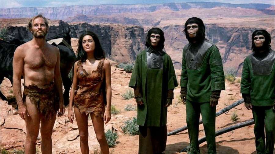
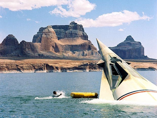
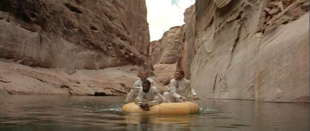
There were more, but you get the idea. Here are a couple more pictures I wanted to share with you from the first Planet of the Apes, filmed at Lake Powell in 1968, four years after the completion of Glen Canyon Dam. I don’t remember where I got these.

Those cool waters of Lake Powell were always so refreshing on hot days.

Boating and fishing in these side canyons was always a treat. But as we all know, these guys are heading toward disaster.

Enjoy!

-Mike

Butler Buildings

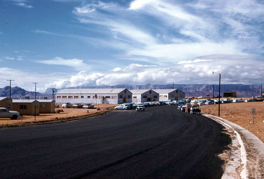
Source: Lonnie Carl DeArmond via Donna Bloxton Petersen. Photo was originally a 35mm color slide. 1958-1959

Here’s a great shot of the Butler Buildings that housed Page Schools in the early years of the town. These sat on the rim where North and South Navajo Drives meet. A few of the pink transa homes are visible on the left side of the photo. The sidewalk and curb on the far side of the road haven’t been poured yet. Click on the image to open it in a new tab. You can see more detail that way. I have an aerial view of these buildings in another post called A Color Aerial View of Page. Does anyone remember what the black-sided building to the right of the Butler buildings was?

Children at Play

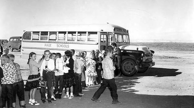
Photo: USBR, Date Unknown

Do you recognize anyone in these photos? Are you in any of these shots? I don’t remember who supplied me with the picture above. It’s uncategorized in my files. But each time I open it, my eyes are drawn to what appears to be a Chevy Suburban behind the bus. After I stare at that Suburban for a second, wishing it was parked in my garage, I realize there are other things in this picture, like children and a school bus. 🙂

I don’t know where this was taken exactly. Maybe in front of the old Butler buildings? There’s no road curbing or pavement yet, if that’s the case. I’m having trouble identifying the plateau on the left side of the picture behind the Chevy. Here’s another one….

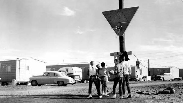
Photo: USBR, 1957

This basketball rivalry took place at the Transa Homes along South Navajo Drive. Are you in this photo or do you recognize anyone in it? If you are or do, please leave a comment below. I’d like to hear the story. The paragraph below concerning the above photo was sent to me from Donna Bloxton Petersen:

Steven Clark “Steve” LeClaire, Page High School Class of 1962, as an 8th grader, December 14, 1957, behind his pink “Transit-Home” near the PHS “Butler Buildings” on South Navajo Drive in Page, Arizona, playing basketball with Howard ’62 & John ’64 Perkins & Paul ’62 & Mack ’63 Page. Steve’s back is to the camera. He is third from left, if you count the boy in front of him. (USBR photo). Steve lived in Kanab, Utah, part of 1957, where he attended first semester of 8th grade while his dad worked on the Glen Canyon Construction Site until their Transit-Home had arrived in Page with the others that made a long row along S. Navajo Drive.

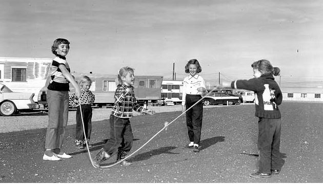
Photo: USBR, undated

Based on the building at the end of the road on the right side of this photo, it looks like it was taken on or near D, E, or F-Street in the MCS Trailer Court. Do you remember those buildings along that road to the airport? They were barracks and a cafeteria for the Dam construction workers. The dirt road they sat along is called Aero Avenue today. Maybe it was called that then too, it’s all a blur at times. From the air, most of those buildings were H-shaped (not that spent a lot of time in the air or anything like that). Also, if you were in this photo or recognize someone in it, please leave a comment.

Enjoy!