Airing Their Laundry

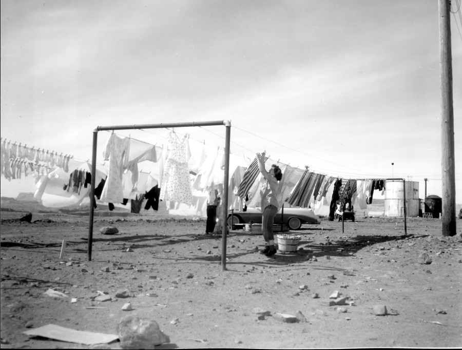
Photo: USBR. Undated. Source: Terry Edwards

This is a fantastic photo! It captures a true moment in the pioneering life of early Page. I’ve closely studied the details in this picture and I’ve concluded that this was taken from behind the transit homes, near South Navajo Drive and Aspen Street. If you click on the pic and open it, you can zoom in and take a look at some of the detail with me. Do you see the tanks on the right side of the image? You can get another look at them in THIS EARLIER POST of the transit homes to see what I’m referring to. In the picture above, the building to the left of the silver tank may be one of the Butler Buildings that housed the first school. Once zoomed in, you can see the canyon in the distance under the laundry. Also notice the second person hanging up clothes and what may be a little girl sitting by the car.

If you know who this woman is, please let me know.

-Mike

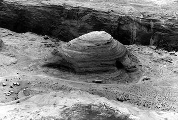
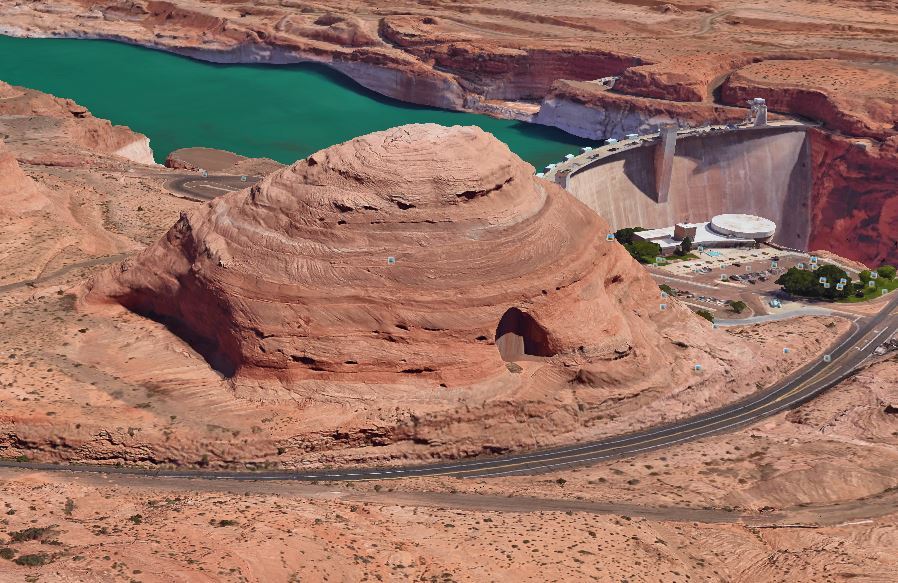
The Beehive Then and Now

The Hive as it looked then….

The Beehive as it appeared in this 1950s photo, showing preliminary construction of Glen Canyon Dam and Bridge. This photo is undated.

The Hive as it looks now…

The Beehive as it appears today. The upper parking lot of the Visitor Center (on the far side of the Beehive) is where the rail-mounted crane towers were located. They were used to lower buckets of concrete into the canyon as well as moving equipment and personnel into and out of the canyon.

The early, undated photo of the Beehive at the top shows preliminary work underway for the Glen Canyon Bridge and Dam. I can’t tell if the east side has been cut away yet. The second picture is one I captured on Google Earth for comparison. I love putting together these then and now pics when I come across them. I’m close to brilliant! 🙂

Be sure to check out my Facebook page at: https://www.facebook.com/pageaz/

-Mike

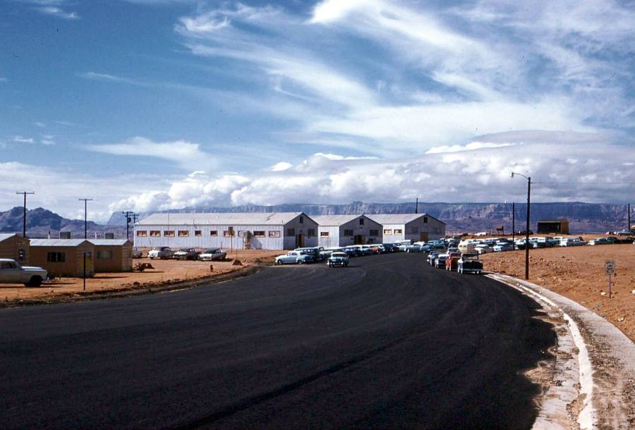
Butler Buildings

Source: Lonnie Carl DeArmond via Donna Bloxton Petersen. Photo was originally a 35mm color slide. 1958-1959

Here’s a great shot of the Butler Buildings that housed Page Schools in the early years of the town. These sat on the rim where North and South Navajo Drives meet. A few of the pink transa homes are visible on the left side of the photo. The sidewalk and curb on the far side of the road haven’t been poured yet. Click on the image to open it in a new tab. You can see more detail that way. I have an aerial view of these buildings in another post called A Color Aerial View of Page. Does anyone remember what the black-sided building to the right of the Butler buildings was?

Children at Play

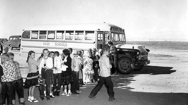
Photo: USBR, Date Unknown

Do you recognize anyone in these photos? Are you in any of these shots? I don’t remember who supplied me with the picture above. It’s uncategorized in my files. But each time I open it, my eyes are drawn to what appears to be a Chevy Suburban behind the bus. After I stare at that Suburban for a second, wishing it was parked in my garage, I realize there are other things in this picture, like children and a school bus. 🙂

I don’t know where this was taken exactly. Maybe in front of the old Butler buildings? There’s no road curbing or pavement yet, if that’s the case. I’m having trouble identifying the plateau on the left side of the picture behind the Chevy. Here’s another one….
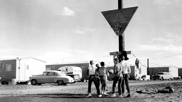
Photo: USBR, 1957

This basketball rivalry took place at the Transa Homes along South Navajo Drive. Are you in this photo or do you recognize anyone in it? If you are or do, please leave a comment below. I’d like to hear the story. The paragraph below concerning the above photo was sent to me from Donna Bloxton Petersen:

Steven Clark “Steve” LeClaire, Page High School Class of 1962, as an 8th grader, December 14, 1957, behind his pink “Transit-Home” near the PHS “Butler Buildings” on South Navajo Drive in Page, Arizona, playing basketball with Howard ’62 & John ’64 Perkins & Paul ’62 & Mack ’63 Page. Steve’s back is to the camera. He is third from left, if you count the boy in front of him. (USBR photo). Steve lived in Kanab, Utah, part of 1957, where he attended first semester of 8th grade while his dad worked on the Glen Canyon Construction Site until their Transit-Home had arrived in Page with the others that made a long row along S. Navajo Drive.
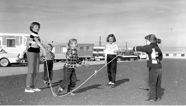
Photo: USBR, undated

Based on the building at the end of the road on the right side of this photo, it looks like it was taken on or near D, E, or F-Street in the MCS Trailer Court. Do you remember those buildings along that road to the airport? They were barracks and a cafeteria for the Dam construction workers. The dirt road they sat along is called Aero Avenue today. Maybe it was called that then too, it’s all a blur at times. From the air, most of those buildings were H-shaped (not that spent a lot of time in the air or anything like that). Also, if you were in this photo or recognize someone in it, please leave a comment.

Enjoy!
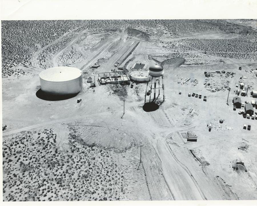
Got Water?

A couple of years ago I did a post on the lower water treatment plant. It was a temporary treatment plant located in the canyon that was in operation until the new one was up and operational. Here’s a link to it to stir your memory:

https://mikesdamphotoblog.com/2014/01/21/the-lower-water-treatment-plant/

In this post I want to share some pictures of the construction of the upper water treatment plant. This is the water treatment facility that is still in operation behind Chapman’s Trailer Court. What you won’t see in these pics is the go-cart track that was built next to it a couple of years later. But if you look at a Google Earth image (or drive over there if you’re local), you can still see remnants of the asphalt track.

Enjoy!

Image Source: The LeGate Family

Keep going…there’s more to see —>

Continue reading

Operation Glen Canyon

This is a pretty cool  28 minute video documentary on the first four years of construction of Glen Canyon Bridge and Dam. Thank you Donna for posting this link on our Facebook page!

Enjoy!

A Day in the Life: 10-30-1958, Part Two

This is part two of my previous post featuring newspaper clippings from the October 30, 1958 edition of the Page Signal, the forerunner to the Lake Powell Chronicle. Here’s some more happenings that were printed that week:

Photo Courtesy of the LeGate Family. Page Signal: 10-30-1958.

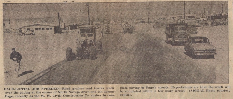
If my compass is correct, this is a look east along North Navajo and Seventh Avenue (now Lake Powell BLVD) is about where the photographer is located. You can see some of the early businesses  and a little of the MCS trailer court in the top right of the photo. I talked about them in some previous posts. You can see a clearer picture of those first buildings —>HERE<—

Doctor Kazan was the happy recipient of Page’s 300th phone! You can see an Continue reading

A Day in the Life 10-30-1958

Source: The LeGate Family
Page Signal: 10-30-1958

Gene LeGate loaned me a box of old Page Signal newspapers that I’ve been scanning as I have time. The Page Signal was Page’s first newspaper and pre-runner to The Lake Powell Chronicle. I’m scanning these old newspaper stories and pictures and will be posting them from time to time in a new category called A Day in the Life. Catchy, I know. 🙂 This first one is dated October 30, 1958.

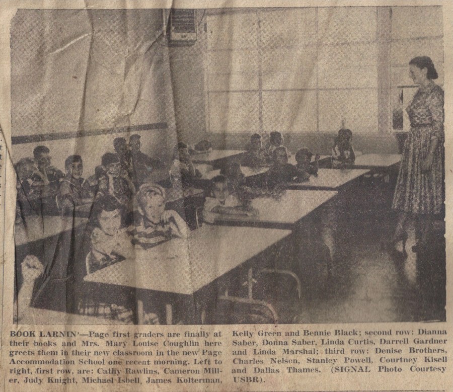
Do you remember a post I did a while back called School Daze? I didn’t know it then, but the first two pictures in that post appeared in the Page Signal. To see that School Daze post, just click —>here<—. Here are the two pictures from the Signal. The captions gives us names. Pretty cool!

If you still have that School Daze post open, look at the second picture of the kids lined up by the old X and Y school buildings. Here it is again as it appeared in the Page Signal, complete with names. 

Continue reading

Early Page Businesses

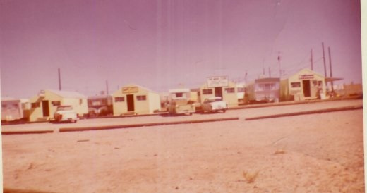
In this post I want to share with you my remaining pictures of the first Page business district. I am indebted to Petey Lloyd Dietz, Ernie Severino Jr., and Terry Edwards for these pics. As a reminder, these businesses were located close to each other with the small shack businesses in a row along North Navajo Drive, and the building with the bank and Babbitt’s located just behind The Bottle Stop (now Stix Market). You can see exactly where they were in [this post]. Check these out…

Photo Courtesy of Terry Edwards. Undated

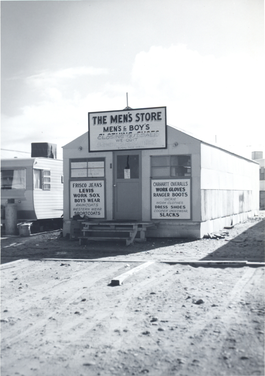
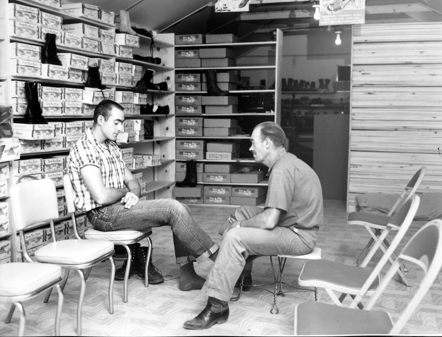
The Men’s Store was going out of business when the above picture was taken. I’m not sure of the date.  The strike of 1959 may have contributed to the decision to close. The picture below shows Grant Jones with a customer. I don’t know who the customer is or if it was taken inside the Men’s Store.

Photo Courtesy of Terry Edwards. Undated.

The photos below show the early businesses from different perspectives.

Photo Courtesy of Ernie Severino Jr. Undated.

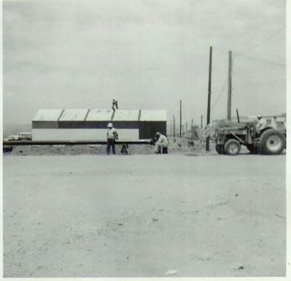
Warner’s Firestone building under construction. Photo Courtesy of Ernie Severino Jr. Undated.

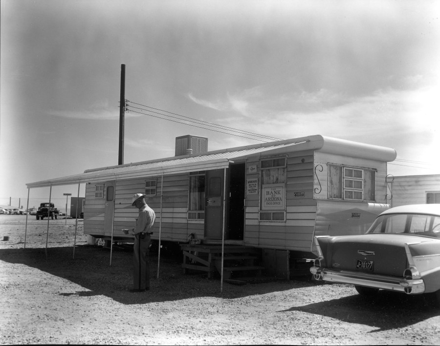
Before we go any further, check out this picture of the bank, located in the same are:

Photo Courtesy of Terry Edwards. Undated.

That looks pretty safe! As long as nobody drives off with it. I can’t make out who that is standing there. The street sign says B Street. The sign in the window just says The Bank of Arizona Page Office.

As you face these buildings, looking south from North Navajo, Babbitt’s and newer location of the Bank, were just off to the right, behind Continue reading