1959 Aerial Photo of Page, Arizona

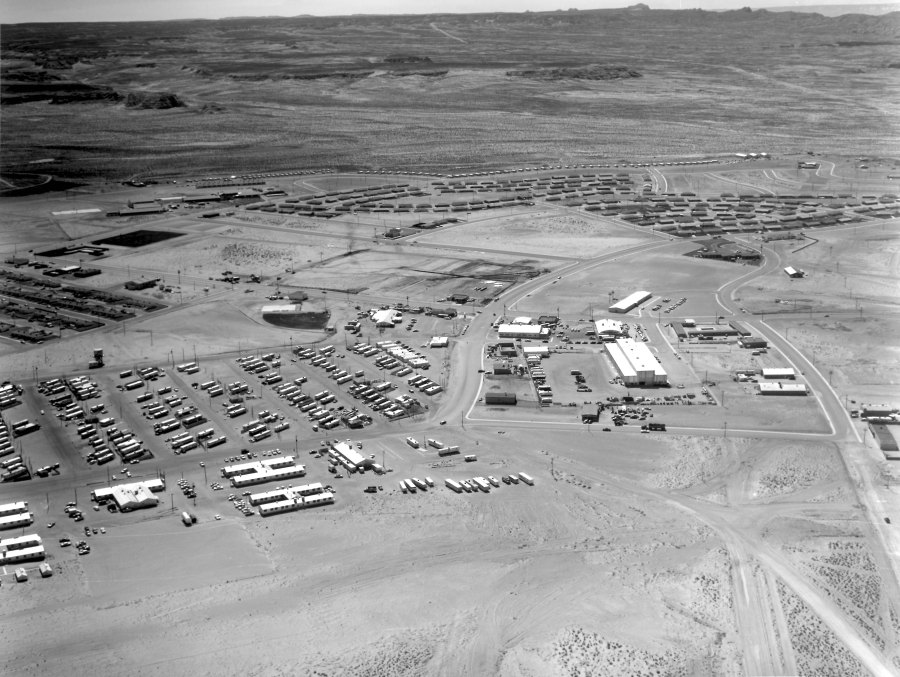
1959 Aerial View of Page, Arizona. Photo Courtesy of Terry Edwards.

Some of my favorite early pics of Page and the surrounding area are these old black and white aerial shots. You can see a lot of detail and they always bring back memories of what it was like. One of the reasons I’m posting this one is because in my next post or two, I’ll be highlighting some early businesses and I want you to have a reference point for their location if you’re not familiar with it.

We have a lot to talk about in this photo. Click on it to open it up and you’ll be able to zoom in. Let’s start on the right side, as you come into town on 7th Avenue. The Glen Canyon Steak House and Motel aren’t there yet, but it looks like the ground is being cleared for their construction. To the right, along Vista Ave., you get a good look at the Page Hospital and what was at that time, the USBR offices. You can see a close-up of that building and read more about it HERE. You can also see/read more about the hospital HERE. Okay, back to our journey up 7th Avenue. The next building on the left is the Page Boy Motel. The building across the street was the Vostron building and now houses the City of Page offices.

The building across from Vostron on this side of 7th Avenue is the bowling alley. The big rectangle building just this side of the bowling alley is the USBR warehouse. The white rectangle building to the left of the bowling alley in this photo was (is?) the fire station. The smaller building that’s attached to the right end of the fire station was the USBR Ranger station. The only thing I remember being in the Continue reading
The Birth of a Town

Photo: USBR. Undated. Photo Courtesy of Terry Edwards

Here’s an early shot of Page taken from the rim where North Navajo Drive and South Navajo Drive meet. Those are the Transit houses that dotted the rim along South Navajo and Aspen Street. As you can see, they are still being placed on site. The roads are being graded and the ground cleared. Notice the sewer pipe laying on the ground, awaiting installation. This photo is undated, but it has to be 1957 or 58. For comparison, look at the second picture I posted in the second blog on this site. It’s an aerial view showing the curve and the first airstrip which was about where this photographer was standing, along North Navajo. See it HERE.

Okay, back to this photo. There’s a school bus there because the Butler buildings were just to the right of this picture. They housed the first Page schools and they sat on the rim. You can see them in the link I provided above. I remember being told the water tank in the background of this picture was temporary while the town’s permanent water treatment plant was being built. I think that’s the water treatment plant being built in the far background. Did you know that the first water treatment plant for the town of Page was at the bottom of the canyon? It’s no doubt what supplied water to these tanks. See it HERE. Don’t miss the guy walking away on the left edge of the picture, as well as the outhouse. This picture provides a clear look at Le Chee on the horizon.

-Mike

The Left Key-Way

Photo: Probably USBR. Courtesy of Terry Edwards. Undated

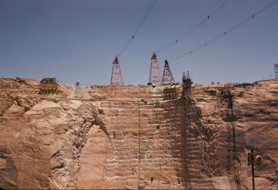
Here’s a great look at the left (Page side) key-way for Glen Canyon Dam. The key-ways were the vertical cut outs in the canyon walls where the dam was anchored into the rock. You can see two rectangle tunnels in the key-way and a third one to the right. I’m not sure what that third one was for, but there were a total of four of the other tunnels spaced along both key-ways. As the dam was built, these were connected to walkways inside the dam that ran the full length of the dam from edge to edge. There was instrumentation placed in those tunnels to measure stability and movement, and probably a lot of other things I’m not aware of. But having been inside at least one of them once the dam was finished, I remember how cold, wet, and eerie it was. I can also still remember the smell – like wet concrete. But I digress.

The towers above were the mobile cranes that rode along tracks and could move back and forth to move materials, people, and dump concrete buckets during the construction of the dam. There were three more on the opposite side of the canyon, behind the photographer. On the right side of the key-way is an elevator that ran on vertical rails up and down the canyon wall. I remember watching that thing from the bridge as it shuffled people in and out of the canyon. It seems like there was another smaller one to the right of that one, but it’s all a blur. I’m not sure what the wooden structures at the top of the key-way were.

Enjoy,

-Mike

Friday Freebie: How To Navigate a Foot Bridge

From my archives. Undated and source unknown.

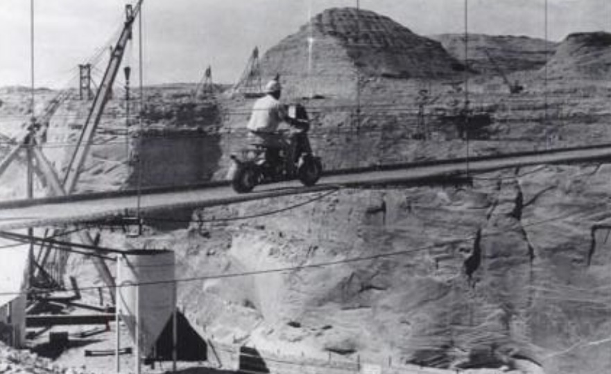
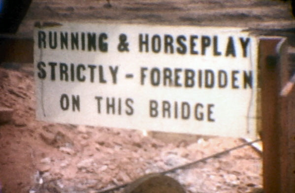
Here’s a little something to take into your weekend. Remember, always wear a helmet. Especially if you’re crossing a footbridge 700+ feet above a canyon floor, with minimal or no side rails.

-Mike

Below The Coffer Dam

Photo: USBR. July, 1959. Courtesy of Terry Edwards.

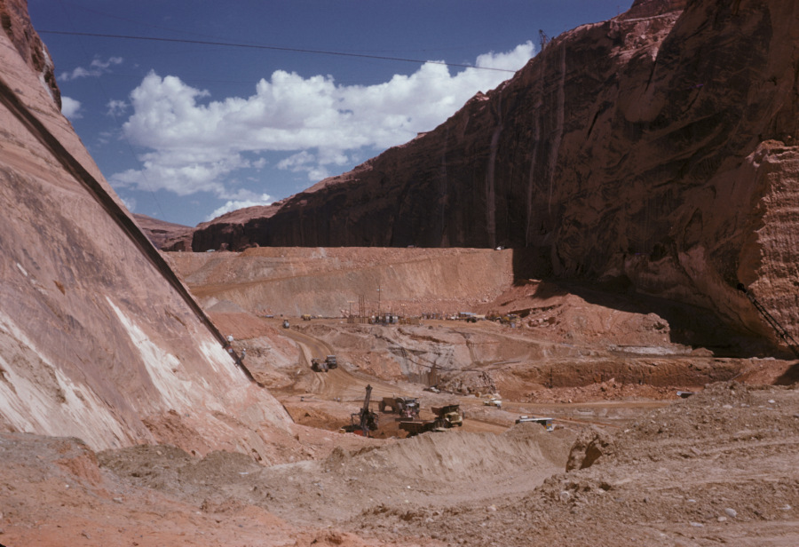
I love the detail in these old USBR photos. If you zoom in on them, you can see some pretty cool stuff. This one is no exception. It gives us a good downstream look at the temporary coffer dam. You are looking upstream toward what would eventually become Lake Powell. The coffer dam was built to divert the Colorado River water into the two spillway tunnels that routed the water through the canyon walls to the downstream side of the dam site. The right side tunnel (the Visitor Center side) was the primary tunnel and it handled most of the diversion water.

The excavation going on in this picture is prep work for laying the base of the dam. I remember reading or hearing somewhere that the base concrete for Glen Canyon Dam was poured 135 feet below bedrock. This picture captures that excavation. Some of the dirt and rock that was Continue reading

Temporary Trailer Camp

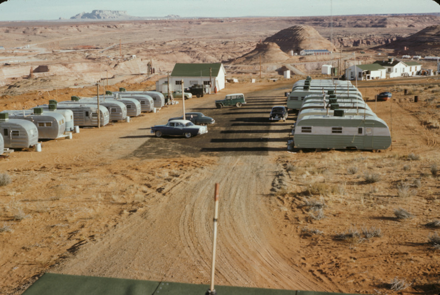
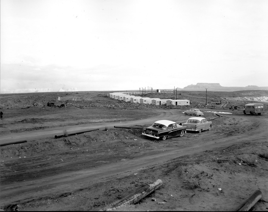
This is a great shot of a temporary trailer park at the Glen Canyon Dam construction site. I don’t have any information about when it was built, why, or how long it was there. I do know it was temporary because it sits on part of the spot where the conveyor belts for delivering the aggregate to the batch plant were eventually built. They would have been just to the right of this picture, and probably would have extended into the picture a little.

It’s a good look at the Beehive from the north. It doesn’t look like the canyon side of the Beehive has been removed yet, but it’s hard to tell. The bridge isn’t there yet, but construction is underway. On the left side of the picture, you can see the top of the left spillway. Also, along the highway, that large building that was used as some kind of laydown yard is framed, but not finished yet. If you zoom in, you can see the water tower in town. It’s also a good shot of LeChee. The buildings on the left side of Manson Mesa may be the corals and drive-in theater.

Ok, back to the trailer park. Does anyone know what the white buildings were? I’d give good money for the Willy’s jeep. The boat without a trailer is classy. Enjoy!

Date and Photographer Unknown, but from the 1950s
Source: Terry Edwards

-Mike

The Upper Footbridge

Source: Terry Edwards
Undated and the spell-checker must have been broke. :)Source unknown and photo is undated

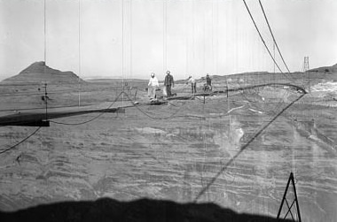
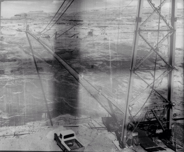
This is a longer post than most of my others and there are several pictures. Make sure you see them all. Before and during the construction of Glen Canyon Bridge, the footbridge served as a means for foot traffic (and evidently, at least one VW Beetle) to get from one side of the canyon to the other. The footbridge was located a short distance upstream from the dam – far enough upstream to not interfere with the construction. It’s visible in several of the photos I’ve posted and I’ve mentioned it a few times in different posts. This post is solely about the upper footbridge and there are several pictures.

I don’t know the source of this first picture below or the date, but it’s a great shot of the bridge that gives you a good idea of the size and scope. This bridge was completed in 60 days.

Source unknown and photo is undated

That’s a sweet picture isn’t it. That was no small task for something that would be temporary. There’s a big part of me that wishes it was still there. Here’s another view from ground level that shows some of the parking and a dry Wahweap bay in the background.

Continue reading

The Silver Screen

Photo: USBR, photographer unknown
Source: Terry Edwards

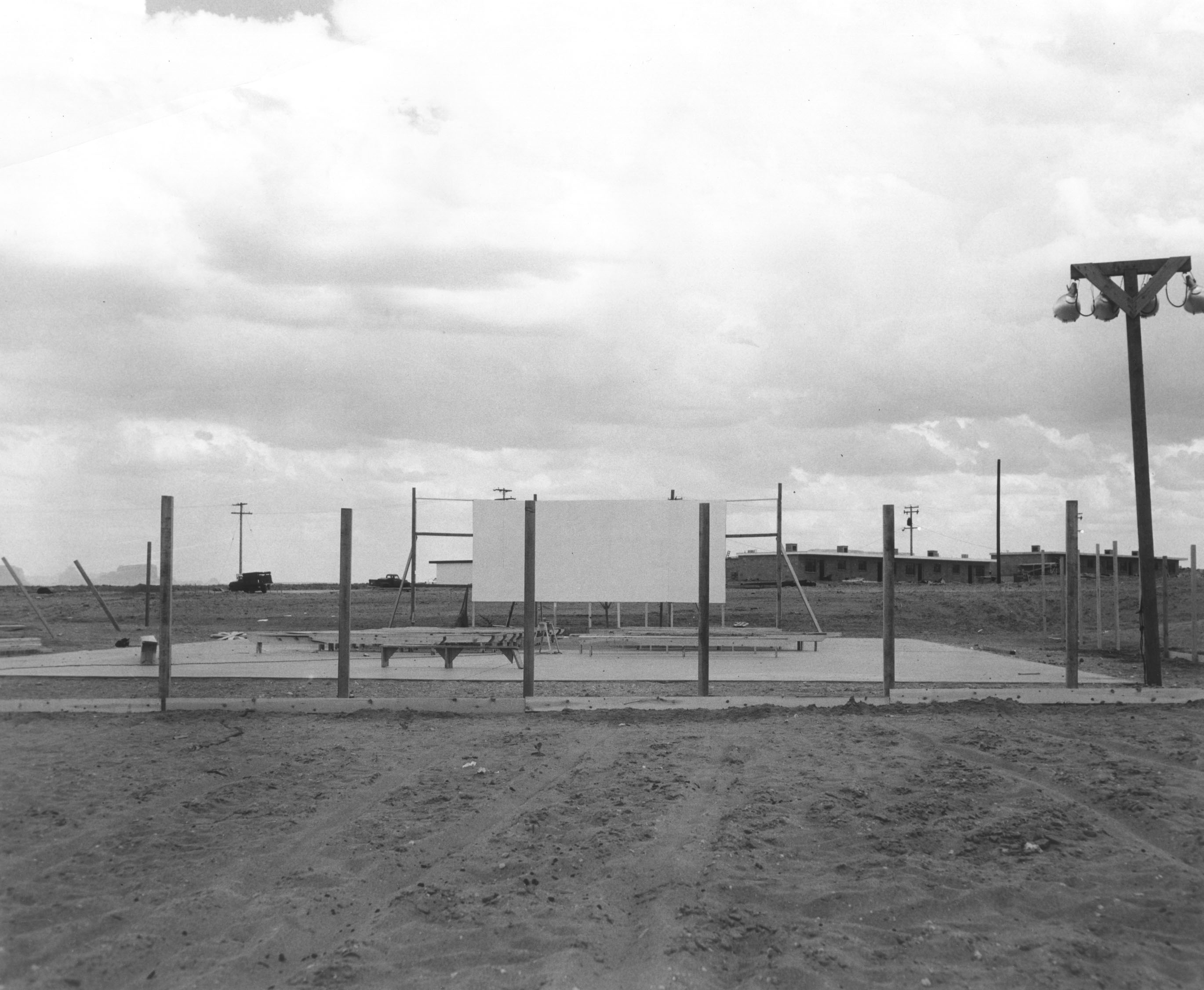
Do you remember this? I think it predates the drive-in theater that soon popped up north of town by the corrals. Those aren’t there anymore either. This makeshift theater was located behind Keisling’s gas station at the approximate location of the current radio station. The MCS apartments are in the background and there was a Little League field to the left of this picture. Did this site become an ice skating rink for a short time, or am I having a senior moment?

-Mike