Frozen in Time

57-58-aerial-e1374406096216
Late 1950s Page Arizona
Source: Unknown

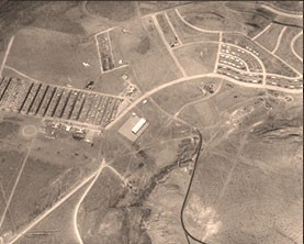
This aerial view of the early town of Page captures a time long since past. This has to be 1957-58 or possibly early 59. I love how the paved road into town just stops and dirt takes over. The USBR warehouse is the rectangle building near the center of the picture. It’s still there today. The trailer court is the development across from it. The trailer court streets were named with letters.

We lived at the airport (right behind the hanger) and the street nearest us was P Street. I’m assuming the names started at A Street at the other end of the court, but my memory is fuzzy at that point. The buildings just below the trailer court near the present day corner of Aero and Cathedral (across from present day Fred’s Liquor and the old Warner’s Nursery) comprised a chunk of the business district. Firestone, Page Jewelers, and a locksmith shop were there. I have a picture I’ll be posting of it soon.

The group of buildings near the other corner of the trailer court (close to present day Lake Powell BLVD) included Babbitt’s and First National Bank. This picture may have been taken before those businesses occupied those buildings, but if so, they eventually found a temporary home there. I have a picture of those buildings I’ll be posting as well.

Just above those buildings is the MCS apartments. There are only a couple of streets there in this picture, so construction was still progressing.

On the right side of the picture, you can see some houses along N. Navajo Drive, Gum, Elm, and Fir Streets. There may have been a few houses built or being built along the north end of Date Street too. I don’t know if that’s the hospital on Vista and N. Navajo. I’m not sure when that was built. If any of you old-timers want to add anything by way of comments, please do.

-Mike
Color Aerial View of Page

1958-59 Aerial Shot
1958-59 Page Arizona
Source: Unknown

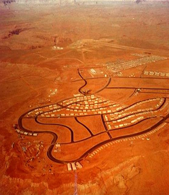
This is a rare color photo of Page taken in 1958-59 near the beginning of the construction of Glen Canyon Dam and bridge. You can see the airport in the distance (where yours truly lived, starting in 1960). The large rectangle area just this side of the airport is the Merritt-Chapman & Scott (MCS) trailer court. I had a paper route in that trailer court and there were some mean dogs in there that liked to chase paper boys on bikes. The buildings in the upper right of the photo are the MCS apartments on 8th an 9th avenue. It looks like they were still under construction since there’s only two rows of them.

The three buildings at the bottom of the picture were the Butler buildings that housed the Page schools until the permanent school was finished in 1959-60. The small buildings to the right of the Butler buildings were the old transit homes. These were all painted a hot pink and were initially there to provide housing for the construction workers.

The large rectangle building near the center of the picture is the US Bureau of Reclamation warehouse and is still there today. One of the first high school graduations took place inside that building in 1959. I have a picture that I’ll be posting of it soon. I’m not sure what the three white structures are in the top left of the picture, but the horse corrals and drive-in theatre were eventually built near that spot. I remember watching movies like Ben-Hur, The Man Who Shot Liberty Valance, and The Greatest Story Ever Told (among others, but I don’t want to bore you) at that theatre. The drive-in was tore down quite some time ago.

The permanent school buildings are no doubt under construction at the time of this picture, but are off to the right and not shown. This is a good shot of Date Street and First and Second Avenue, which sat empty like that for years.

For an interesting comparison, compare this picture with the earlier one that I posted HERE.

-Mike

Early Aerial Shot of Page

Very early aerial shot of Page. I’m thinking pre-1958 since the Butler buildings aren’t there. This picture was embedded in a Word document who’s author was Greg Woodard. Very cool pic!

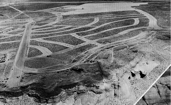
This is one of my favorite pictures. This view shows the original dirt airstrip that cuts through what is now part of North Navajo drive, First Avenue, Date Street, Elm Street, etc. You can see a couple of airplanes parked at the end of the runway. The Butler Buildings weren’t there yet (they were the early school buildings located on the curve of Navajo drive near the bottom of this picture). Construction was starting for the transa homes along South Navajo Drive and the MCS trailer court in the distance. This is an amazing picture.

-Mike

Add a Page to Your Trip

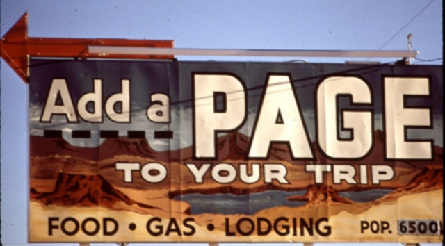
This sign was on US 89 and welcomed early visitors to Page.

I thought it was a good idea to give my first post this title. For many years there was a small wooden sign near the north exit to Page on US 89 that read “Add a Page to Your Trip”. It was eventually replaced by the one above but today, neither is there.

-Mike